


Recently released flood maps created by FEMA for the city of New Orleans are receiving criticism for being 'overly optimistic' when it comes to risks posed by hurricanes and rising sea levels.
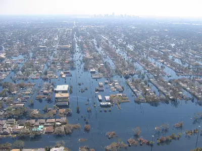
In an Op-Ed in The New York Times, Tulane University professor Andy Horowitz finds fault with the recently released flood maps for New Orleans that downplay risks in potentially vulnerable neighborhoods across the city. Horowitz writes that FEMA's original flood maps, drafted in 2009, were redrawn following complaints by New Orleans officials that they failed to take into account the new levee protections built after Hurricane Katrina. The new maps show no flood risks in many of the neighborhoods that flooded during Katrina, meaning homeowners in those neighborhoods no longer are required to buy flood insurance. Horowitz sees a potential catastrophe in the making.
[M]any of us will hold our breath through hurricane season nonetheless, because we know that the new maps reflect questionable assumptions. First, they assume that this time the Army Corps of Engineers’ work can be trusted, and the levee system will not fail again. ...a likely outcome of this new federal policy is that when — not if — New Orleans floods again, thousands of people will be worse off than they were during Hurricane Katrina: When their homes flood, they will not have flood insurance.
FULL STORY: New Orleans’s New Flood Maps: An Outline for Disaster

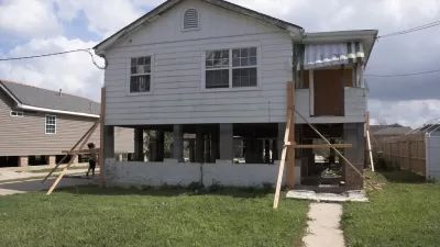
Louisiana Dials Back Requirements for Elevating Homes in Flood Areas
Housing market pressures, flood insurance costs, changing FEMA maps, and improved methods of flood control are giving victims of flood damage in Louisiana mixed signals on how high they should rebuild their homes.
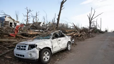
The Growing Role of Federal Government in Disaster Relief
As flooding, fires, and other disasters become more destructive, an effective response requires more resources than local governments can offer.
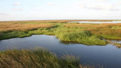
New Orleans Convent to Become Large Urban Wetland
Hurricane Katrina damaged a Catholic convent in New Orleans. Then the nuns spearheaded a project to transform the land into a wetland area that will protect the city from flooding in the future.

Planetizen Federal Action Tracker
A weekly monitor of how Trump’s orders and actions are impacting planners and planning in America.

Congressman Proposes Bill to Rename DC Metro “Trump Train”
The Make Autorail Great Again Act would withhold federal funding to the system until the Washington Metropolitan Area Transit Authority (WMATA), rebrands as the Washington Metropolitan Authority for Greater Access (WMAGA).

The Simple Legislative Tool Transforming Vacant Downtowns
In California, Michigan and Georgia, an easy win is bringing dollars — and delight — back to city centers.

The States Losing Rural Delivery Rooms at an Alarming Pace
In some states, as few as 9% of rural hospitals still deliver babies. As a result, rising pre-term births, no adequate pre-term care and "harrowing" close calls are a growing reality.

The Small South Asian Republic Going all in on EVs
Thanks to one simple policy change less than five years ago, 65% of new cars in this Himalayan country are now electric.

DC Backpedals on Bike Lane Protection, Swaps Barriers for Paint
Citing aesthetic concerns, the city is removing the concrete barriers and flexposts that once separated Arizona Avenue cyclists from motor vehicles.
Urban Design for Planners 1: Software Tools
This six-course series explores essential urban design concepts using open source software and equips planners with the tools they need to participate fully in the urban design process.
Planning for Universal Design
Learn the tools for implementing Universal Design in planning regulations.
Smith Gee Studio
City of Charlotte
City of Camden Redevelopment Agency
City of Astoria
Transportation Research & Education Center (TREC) at Portland State University
US High Speed Rail Association
City of Camden Redevelopment Agency
Municipality of Princeton (NJ)