


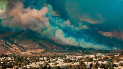
New research says land use patterns have increased the costs of wildfire protection, so strategic land use planning would help lower the costs of wildfire protection.
"Building houses far apart and in locales beyond town -- the wildland-urban interface -- increases firefighting costs in the Rocky Mountain West, according to a new report from the Open Spaces Initiative at the University of Wyoming."
The news comes via the University of Wyoming website, which also notes that the study's authors argue for strategic land-use planning to "reduce wildfire suppression costs by increasing firefighting efficiency." Moreover, the "dramatic rise in firefighting costs over the last decade is due, in part, to the growth of residential development in the wildland-urban interface"—otherwise known as poor land use planning.
The efficiency of firefighting efforts falls precipitously as homes get farther apart in wildland areas. According to the study. "Using data from 291 wildfires in Colorado, Montana and Wyoming from 2002-2011, researchers found a single isolated home can add $225,000 to overall firefighting costs, while a home within a dense cluster can contribute as little as $100."
Hat tip to Shane Phillips for sharing the post.
FULL STORY: New Report Suggests Strategic Land-Use Planning Can Increase Firefighting Efficiency

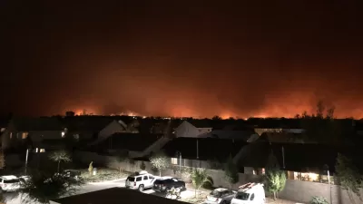
Home Insurers Are Fleeing California
Homeowners in the state are finding it increasingly difficult to secure insurance policies thanks to the growing risks of wildfire, drought, and other climate threats.
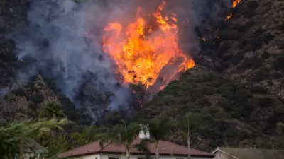
Between a Rock and a Hard Place: Housing and Fire Safety in California
A proposed development near the site of the devastating Camp Fire highlights the growing tension between building badly needed housing and protecting communities from heightened wildfire risk.
California Needs More Housing—But Where?
The state’s housing shortage is complicated by the growing number of places threatened by wildfires.

Planetizen Federal Action Tracker
A weekly monitor of how Trump’s orders and actions are impacting planners and planning in America.

Restaurant Patios Were a Pandemic Win — Why Were They so Hard to Keep?
Social distancing requirements and changes in travel patterns prompted cities to pilot new uses for street and sidewalk space. Then it got complicated.

Map: Where Senate Republicans Want to Sell Your Public Lands
For public land advocates, the Senate Republicans’ proposal to sell millions of acres of public land in the West is “the biggest fight of their careers.”

Maui's Vacation Rental Debate Turns Ugly
Verbal attacks, misinformation campaigns and fistfights plague a high-stakes debate to convert thousands of vacation rentals into long-term housing.

San Francisco Suspends Traffic Calming Amidst Record Deaths
Citing “a challenging fiscal landscape,” the city will cease the program on the heels of 42 traffic deaths, including 24 pedestrians.

California Homeless Arrests, Citations Spike After Ruling
An investigation reveals that anti-homeless actions increased up to 500% after Grants Pass v. Johnson — even in cities claiming no policy change.
Urban Design for Planners 1: Software Tools
This six-course series explores essential urban design concepts using open source software and equips planners with the tools they need to participate fully in the urban design process.
Planning for Universal Design
Learn the tools for implementing Universal Design in planning regulations.
Heyer Gruel & Associates PA
JM Goldson LLC
Custer County Colorado
City of Camden Redevelopment Agency
City of Astoria
Transportation Research & Education Center (TREC) at Portland State University
Camden Redevelopment Agency
City of Claremont
Municipality of Princeton (NJ)