Traffic fatalities are on pace to reach 35,000 in the United States this year. Some advocates are saying it's time for traffic engineers to stop blaming the victims.


"US traffic deaths are rising again—fatalities jumped 8.1 percent in the first half of 2015, National Highway Traffic Safety Administration (NHTSA) reports," according to an article by Robert Steuteville.
Steuteville notes that the NHTSA cites "drunken, drugged, distracted and drowsy driving; speeding; and failure to use safety features such as seat belts and child seats," for the increase in tragedy, but he wishes they'd acknowledge another D—the "design of streets and communities." When it comes to design, argues Steuteville, the "bigger is better" approach always wins out—even when all evidence suggests that smaller lanes reduce risks.
"The NHTSA reaction to the current trend in fatalities shows that evidence continues to be ignored. Not everywhere: In the alphabet soup of agencies that govern streets and highways, the Federal Highway Administration (FHWA) recently admitted that wider lanes have no safety benefit on thoroughfares designed for less than 50 mph. This is a small step in the right direction, given that wider lanes degrade safety in urban conditions. It is time for transportation engineers to look in the mirror, own up to the damage done to people and communities, and disavow once and for all the 'bigger is better' approach to urban thoroughfares."
The article surveys some of the influential studies that make the case for a design solutions that could start reducing the loss of life on U.S. streets, roads, and highways before arriving to that frank conclusion. Of particular interest in the definitive 2008 study by Garrick and Marshall, which found that newer cities in California laid out with wider streets and longer blocks have three times more traffic fatalities per capita than cities built before 1950.
That Garrick and Marshall study was also of particular interest to Angie Schmitt at Streetsblog, who deserves a hat tip for sharing this article.
Read the full story: As traffic deaths rise, blame engineering dogma

Despite Stay-at-Home Orders, U.S. Traffic Deaths Rose in 2020
Dangerous behaviors picked up during the early, low-traffic days of the pandemic are partly to blame.

Let’s End Traffic Stops
The technology to make traffic enforcement obsolete is becoming available. But in the U.S. willing to use it?
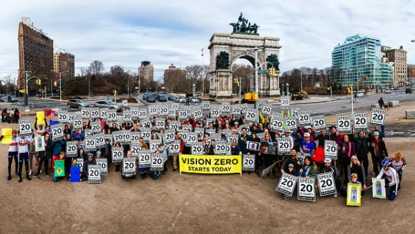
Traffic Fatalities Set Records as Pandemic-Era Road Carnage Shows No Signs of Stopping
An estimated 42,915 people died in automobile crashes in 2021, according to recent federal data. The increasing fatalities continue a trend that began with the outset of the pandemic.

Planetizen Federal Action Tracker
A weekly monitor of how Trump’s orders and actions are impacting planners and planning in America.
Washington state to charge fee to drivers with fuel-efficient cars
Revenue from the fee will go towards supporting the state’s highways.

Illinois considers spending $1 billion in taxpayer money on data center
A quantum computing campus and data center are currently under construction in Chicago.

Senate passes bill overhauling permitting
The bill still needs to pass the House.

Did data centers change how voters cast their ballots?
Texas, Ohio, and Georgia all flipped party control. But in rural counties, the effect of local data centers was mixed.

Amtrak invests in eight new Airo trainsets
The new trainsets will begin serving passengers in 2031.

FREE Course: Walkable City 1: Why Walkability?
After describing his path towards focusing on walkability as the essence of good planning, Jeff Speck marches through his five principal reasons for making more walkable places.
Reinventing Malls: Planning Alchemy—Turning Gray Fields Into Gold
The course focuses on the opportunities and imperatives that shape reinvention of mall sites.

City of Charlotte
City of Rosemead
Rutgers University, Edward J. Bloustein School of Planning and Public Policy
University of Michigan School for Environment and Sustainability (SEAS)
Hunter College, City University of New York (CUNY)
The Architects Foundation
University District Partnership