


No, this is not a trick question. By definition, you'd think the answer is L.A., where the heat is generated, but it's actually San Bernardino, 56 miles to the east. Turns out that like ozone, heat is transported by the wind.

"Heat islands are created by a combination of heat-absorptive surfaces (such as dark pavement and roofing), heat-generating activities (such as engines and generators), and the absence of vegetation (which provides evaporative cooling)," according to the Urban Heat Island Index for California from the California Environmental Protection Agency (CalEPA).
Using the new index which tracks temperatures across the state, CalEPA found that "[t]he highest temperatures crop up east of downtown Los Angeles and are pushed into the inland valley by ocean breezes," writes Sanden Totten, science reporter for KPCC. [Listen here]
"In that way we found that the urban heat island effect in the L.A. area really mimicked the ozone pollution problem in L.A. where it moved east and settles against the hills," said Gina Solomon, Deputy Secretary for Science and Health with CalEPA.
She adds that the index, a result of 2012 legislation (AB 296, Chapter 667, Statutes of 2012), is a way of "quantifying the urban heat island effect." It "is designed so that cities can have a quantifiable goal for heat reduction," according to the webpage.
"We call it not an urban heat island but an urban heat archipelago because it's like a whole chain of urban heat islands that run into each other," Solomon said.
“The Urban Heat Island Index offers state and local governments a tool to help prioritize areas for programs that reduce heat in urban communities, such as urban greening projects and cooler roofs and pavements," notes the press release.
FULL STORY: LA area has highest urban heat island effect in California

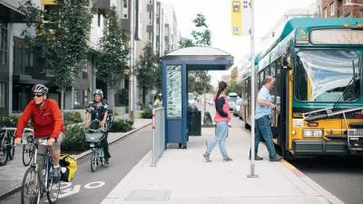
As Heat Waves Become More Common, Bus Shelters Are Needed to Keep Transit Riders Onboard
As climate change brings prolonged, intense heat waves to cities once associated with rain and cold weather will have to attend to the lack of shelter provided to bus and transit riders.

The Problem with Tree Planting Programs
Ambitious campaigns to plant trees in urban areas often don't take into account the complexities of growing and maintaining effective urban forests.

How Extreme Heat Threatens the Electrical Grid
Higher demand for electricity and lower capacity for production due to more intense heat waves are straining the power grid and causing concern for future energy production.

Maui's Vacation Rental Debate Turns Ugly
Verbal attacks, misinformation campaigns and fistfights plague a high-stakes debate to convert thousands of vacation rentals into long-term housing.

Planetizen Federal Action Tracker
A weekly monitor of how Trump’s orders and actions are impacting planners and planning in America.

San Francisco Suspends Traffic Calming Amidst Record Deaths
Citing “a challenging fiscal landscape,” the city will cease the program on the heels of 42 traffic deaths, including 24 pedestrians.

Adaptive Reuse Will Create Housing in a Suburban Texas Strip Mall
A developer is reimagining a strip mall property as a mixed-use complex with housing and retail.

Study: Anti-Homelessness Laws Don’t Work
Research shows that punitive measures that criminalized unhoused people don’t help reduce homelessness.

In U.S., Urban Gondolas Face Uphill Battle
Cities in Latin America and Europe have embraced aerial transitways — AKA gondolas — as sustainable, convenient urban transport, especially in tricky geographies. American cities have yet to catch up.
Urban Design for Planners 1: Software Tools
This six-course series explores essential urban design concepts using open source software and equips planners with the tools they need to participate fully in the urban design process.
Planning for Universal Design
Learn the tools for implementing Universal Design in planning regulations.
Heyer Gruel & Associates PA
JM Goldson LLC
Custer County Colorado
City of Camden Redevelopment Agency
City of Astoria
Transportation Research & Education Center (TREC) at Portland State University
Jefferson Parish Government
Camden Redevelopment Agency
City of Claremont