


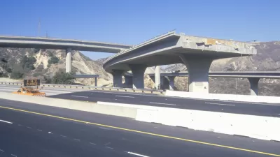
According to a new rule, developers building over known faults will need to drill or take samples to find the rift's exact position. While it slows down construction, the measure might prevent catastrophic future quake damage.

Drought resilience may be a hot topic these days in Southern California, but that doesn't mean an old threat has vanished. A new rule in Los Angeles stipulates that "developers looking to build a new structure in [earthquake risk] spots must first prove they won't be doing so on top of a dangerous fault, according to Ashley Atkinson with Mayor Eric Garcetti's Office."
The rule only applies to faults already mapped by the California Geological Survey. However, "the state doesn't have the funds it would need to map every potentially dangerous fault, leaving a number of well-known faults unmapped, including several in Los Angeles."
This safety measure may put a damper on some projects, but shouldn't prove too difficult a hurdle. From the article: "The new rules will likely slow down some future projects since digging to look for a fault — or 'trenching' as it's known — is time-consuming and can cost tens of thousands of dollars. However, some developers might be able to provide enough evidence by drilling for core samples, Atkinson explained, which is a less involved process."
FULL STORY: LA developers in quake prone-areas must now look for faults first

Want an Earthquake Warning? There's an App for That
A new earthquake warning system is in place in the city of Los Angeles.
Los Angeles Resiliency Strategy Looks Beyond 'The Big One'
Renewable energy, sea-level rise, and, of course, seismic safety are all part of the plan.
Lessons on Resilience and Recovery from 2017's Worst Disasters
Dissecting successful disaster response in places like Houston and Mexico City could help California prepare for the inevitable.

Planetizen Federal Action Tracker
A weekly monitor of how Trump’s orders and actions are impacting planners and planning in America.

Congressman Proposes Bill to Rename DC Metro “Trump Train”
The Make Autorail Great Again Act would withhold federal funding to the system until the Washington Metropolitan Area Transit Authority (WMATA), rebrands as the Washington Metropolitan Authority for Greater Access (WMAGA).

DARTSpace Platform Streamlines Dallas TOD Application Process
The Dallas transit agency hopes a shorter permitting timeline will boost transit-oriented development around rail stations.

Renters Now Outnumber Homeowners in Over 200 US Suburbs
High housing costs in city centers and the new-found flexibility offered by remote work are pushing more renters to suburban areas.

The Tiny, Adorable $7,000 Car Turning Japan Onto EVs
The single seat Mibot charges from a regular plug as quickly as an iPad, and is about half the price of an average EV.

Supreme Court Ruling in Pipeline Case Guts Federal Environmental Law
The decision limits the scope of a federal law that mandates extensive environmental impact reviews of energy, infrastructure, and transportation projects.
Urban Design for Planners 1: Software Tools
This six-course series explores essential urban design concepts using open source software and equips planners with the tools they need to participate fully in the urban design process.
Planning for Universal Design
Learn the tools for implementing Universal Design in planning regulations.
Roanoke Valley-Alleghany Regional Commission
City of Mt Shasta
City of Camden Redevelopment Agency
City of Astoria
Transportation Research & Education Center (TREC) at Portland State University
US High Speed Rail Association
City of Camden Redevelopment Agency
Municipality of Princeton (NJ)