


Central districts have been surging back since the 1980s. But in most cities, the upper third of earners still favor outlying areas and are underrepresented closer to downtown.
In a piece for City Observatory, Daniel Hertz discusses data from a recent study on the changing demographics of American downtowns. The researchers "measured what percentage of people within three miles of their city's central business district lived in a Census tract that was in the top third. Unsurprisingly, in almost every city, that percentage increased dramatically between 1980 and 2010." The article includes a chart demonstrating that shift.
But that story, which has become accepted canon, still doesn't reflect reality for most cities. From the article: "Still, despite all the progress American central cities have made in economic development, it's important to note that most [central downtown] areas remain disproportionately poor. Even in 2010, cities where upper-income neighborhoods were underrepresented in central areas outnumbered those where upper-income neighborhoods were overrepresented by 32 to 17."
Nevertheless, the data shows a clear trend toward concentrated downtown wealth. Hertz notes how that trend depends on the young, educated demographic. "We were also struck by how much overlap there was between the Cleveland Fed's data and our findings from City Observatory's Young and Restless report late last year."
FULL STORY: More evidence on the changing demographics of American downtowns


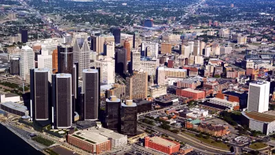
Major US Cities Still Suffering Downtown Decline
Research shows that the “donut effect” hollowing out central business districts since the pandemic continues to cause economic decline in the 12 largest American cities.

A Car-Centric Past and a More Vertical Future in Phoenix
Phoenix has the zoning for more height in its downtown, and future development might finally yield a more recognizable skyline.

Op-Ed: Downtown Denver's Homogenous Renaissance
There's a lot to like about the resurgence of downtown cores. But as is the case elsewhere, Denver's core has only attracted a small subset of the wider city's population. Most people still call the suburbs home.

Planetizen Federal Action Tracker
A weekly monitor of how Trump’s orders and actions are impacting planners and planning in America.

Congressman Proposes Bill to Rename DC Metro “Trump Train”
The Make Autorail Great Again Act would withhold federal funding to the system until the Washington Metropolitan Area Transit Authority (WMATA), rebrands as the Washington Metropolitan Authority for Greater Access (WMAGA).

The Simple Legislative Tool Transforming Vacant Downtowns
In California, Michigan and Georgia, an easy win is bringing dollars — and delight — back to city centers.

Supporting Cycling Takes More Than Just Bike Lanes
Safe, protected bike lanes are a key part of a city’s bike infrastructure — but secure parking, e-bike charging, and other amenities can also influence people’s shift to cycling.

Judge Blocks Anti-DEI Rules for Transportation, Housing Grants
A second injunction blocks the Trump administration from enforcing new regulations for federal funding.

Unhoused People in San Jose Could Face Arrest if They Refuse Shelter
A policy proposed by the city’s mayor would give law enforcement the option to arrest homeless residents if they refuse three offers of housing.
Urban Design for Planners 1: Software Tools
This six-course series explores essential urban design concepts using open source software and equips planners with the tools they need to participate fully in the urban design process.
Planning for Universal Design
Learn the tools for implementing Universal Design in planning regulations.
Smith Gee Studio
City of Charlotte
City of Camden Redevelopment Agency
City of Astoria
Transportation Research & Education Center (TREC) at Portland State University
US High Speed Rail Association
City of Camden Redevelopment Agency
Municipality of Princeton (NJ)