


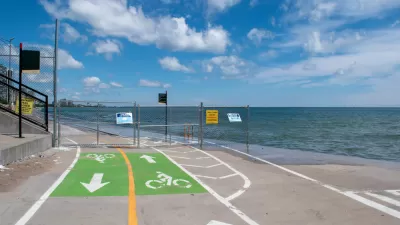
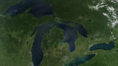
Two academic researchers explain the planning and landscape architecture opportunities offered by the "dramatic fluctuations" and "emergent shorelands" of the Great Lakes Coasts.
Karen Lutsky and Sean Burkholder write about the impact of climate change on coastlines along the Great Lakes. The potential impacts of rising sea levels on cities like New Orleans, Miami, New York City, and San Francisco have been well documented, of course, "[b]ut climatic volatility also affects the Great Lake Coasts," write Lutsky and Burkholder, "where the ice cover last winter was lower than it has been since reliable records began, and the shores are battered by more frequent and more intense storms."
Lutsky and Burkholder acknowledge that the impacts of climate change on the Great Lake Coasts is less predictable and that the tendency could be for planners and environmental managers to view the "cyclically emergent" lands along the Great Lakes Coasts as nuisance zones. But, according to Lutsky and Burkholder, "the very factors that make these lands difficult to appropriate also make them well suited for habitat provision, water quality management, and other beneficial uses."
FULL STORY: Emergent Shorelands of the Great Lakes

Lessons From the Viral Video of Lake Michigan Taking Out a Bike Commuter
Climate change will only increase the frequency of incidents like the one captured by a television news station in Chicago earlier this week.
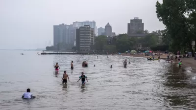
Lake Michigan Continues to Rise, Damaging Property and Infrastructure Along the Way
A tide that began to rise in 2019 hasn't receded, according to local sources along Lake Michigan.
Opinion: Climate Change Has Brought the 'Era of Extreme' to the Great Lakes
Severe flooding in these coastal areas will become the norm, but how to best address the environmental challenges is not entirely clear.

Maui's Vacation Rental Debate Turns Ugly
Verbal attacks, misinformation campaigns and fistfights plague a high-stakes debate to convert thousands of vacation rentals into long-term housing.

Planetizen Federal Action Tracker
A weekly monitor of how Trump’s orders and actions are impacting planners and planning in America.

In Urban Planning, AI Prompting Could be the New Design Thinking
Creativity has long been key to great urban design. What if we see AI as our new creative partner?

Milwaukee Launches Vision Zero Plan
Seven years after the city signed its Complete Streets Policy, the city is doubling down on its efforts to eliminate traffic deaths.

Portland Raises Parking Fees to Pay for Street Maintenance
The city is struggling to bridge a massive budget gap at the Bureau of Transportation, which largely depleted its reserves during the Civd-19 pandemic.

Spokane Mayor Introduces Housing Reforms Package
Mayor Lisa Brown’s proposals include deferring or waiving some development fees to encourage more affordable housing development.
Urban Design for Planners 1: Software Tools
This six-course series explores essential urban design concepts using open source software and equips planners with the tools they need to participate fully in the urban design process.
Planning for Universal Design
Learn the tools for implementing Universal Design in planning regulations.
Gallatin County Department of Planning & Community Development
Heyer Gruel & Associates PA
JM Goldson LLC
City of Camden Redevelopment Agency
City of Astoria
Transportation Research & Education Center (TREC) at Portland State University
Jefferson Parish Government
Camden Redevelopment Agency
City of Claremont