


A recent post on Mobility Lab explains some of the challenges developers encounter when creating the multi-modal trip planner apps of our dreams.
Trevor Gerhardt, a developer with Conveyal who works with OpenTripPlanner, shares some of the problems that arise for plotting multi-modal routes on mobile apps.
Gerhardt introduces the difficulties in multi-modal trip planning by explaining the process by which his team has refined the process for the Washington, D.C.-focused app CarFreeAtoZ: "In the backend of CarFreeAtoZ, we take our search a step further and use subjective values to rank each option based on more than just time. This allows us to tailor options to each commuter as well as the full community in aggregate, instead of just showing the fastest possible trip by default. It also creates a split where we determine which routes to prune by objective measures and which to score and re-rank with subjective ones."
Gerhardt goes on to explain that such a process creates several categories of challenges, including "bike-to-transit pushing out walk-to-transit," "longer transit wait times than ride times," and "when to hide drive-to-transit results." Gerhardt also explains the CarFreeAtoZ approach to each of these challenges and solicits feedback on the routes provided by that system.
FULL STORY: 3 Ways Multi-Modal Travel is Tricky for App Developers

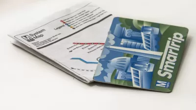
Smartphone Fare Cards Now Available for D.C. Metro
The future is now.
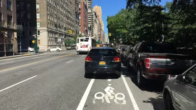
Volunteers Count Almost 700 Vehicles Blocking D.C. Bike Lanes in One Day
Forget bike counts. The new thing in bike advocacy is cars-blocking-the-bike-lane counts.
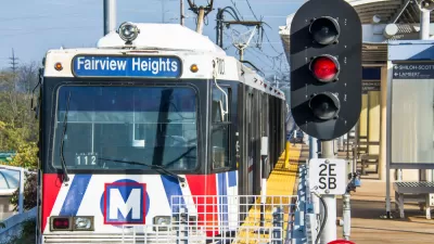
The Transit App Now the Transit App for All of St. Louis
The Transit app will replace the Metro on the Go app for multi-modal trip planning around St. Louis.

Maui's Vacation Rental Debate Turns Ugly
Verbal attacks, misinformation campaigns and fistfights plague a high-stakes debate to convert thousands of vacation rentals into long-term housing.

Planetizen Federal Action Tracker
A weekly monitor of how Trump’s orders and actions are impacting planners and planning in America.

In Urban Planning, AI Prompting Could be the New Design Thinking
Creativity has long been key to great urban design. What if we see AI as our new creative partner?

Massachusetts Budget Helps Close MBTA Budget Gap
The budget signed by Gov. Maura Healey includes $470 million in MBTA funding for the next fiscal year.

Milwaukee Launches Vision Zero Plan
Seven years after the city signed its Complete Streets Policy, the city is doubling down on its efforts to eliminate traffic deaths.

Portland Raises Parking Fees to Pay for Street Maintenance
The city is struggling to bridge a massive budget gap at the Bureau of Transportation, which largely depleted its reserves during the Civd-19 pandemic.
Urban Design for Planners 1: Software Tools
This six-course series explores essential urban design concepts using open source software and equips planners with the tools they need to participate fully in the urban design process.
Planning for Universal Design
Learn the tools for implementing Universal Design in planning regulations.
Gallatin County Department of Planning & Community Development
Heyer Gruel & Associates PA
JM Goldson LLC
City of Camden Redevelopment Agency
City of Astoria
Transportation Research & Education Center (TREC) at Portland State University
Jefferson Parish Government
Camden Redevelopment Agency
City of Claremont