


Allison Arieff provides a glimpse to the San Francisco Planning and Urban Research's new exhibit featuring interesting maps of the San Francisco Bay Area.
San Francisco Planning and Urban Research (SPUR) recently unveiled its latest exhibition on maps depicting a wide variety of topics and themes for both San Francisco and the Bay Area region.
Some of the fantastic maps highlighted in Allison Arieff's piece on Medium show the transit networks in the Bay Area through a variety of methods. One of them is the "City from the Valley" map by Stamen Design, showing the different tech bus shuttle routes throughout San Francisco. Stamen Design usually pulls data from online sources, but in this case all of the information was private so they went out and collected it themselves. The map displays the different companies, their stops, and the amount of trips along the lines.
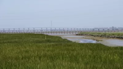
Another excellent map comes from cartographer Brian Stokle and San Francisco institution "Burrito Justice." This set of maps portray the future of the peninsular city with various scenarios of sea level rise. On the more extreme side, a 200-foot rise in sea levels creates the San Francisco Archipelago, with Sutro and Funston Islands, China Beach, and the Bay of Castro. A 25 foot sea rise, which according to the New York Times could be expected in the coming centuries, would flood most of the eastern side of the city, which used to be part of an extensive creek system.
FULL STORY: Urban Cartography

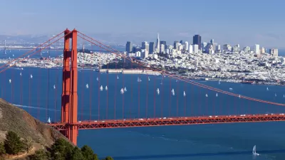
A New Plan for Sea Level Rise in the San Francisco Bay Area
The San Francisco Bay has 400 miles of shoreline, and a dire need for a new approach to dealing with the effects of rising water levels. An estimated $100 billion in potential property damage is at risk.
Bay Area Election Roundup: Wetlands, Housing, Ballot-Box Planning, Sales Tax
A regional measure to tax all property owners in the 9-county Bay Area to adapt to sea level rise passes; S.F. voters support raising the affordable housing bar; Richmond voters reject ballot-box planning; San José approves sales tax increase.
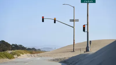
Sea Level Rise Prompts Closure of San Francisco’s Great Highway
The city plans to repurpose a segment of the roadway frequently blocked by blowing sand into a pedestrian plaza.

Maui's Vacation Rental Debate Turns Ugly
Verbal attacks, misinformation campaigns and fistfights plague a high-stakes debate to convert thousands of vacation rentals into long-term housing.

Planetizen Federal Action Tracker
A weekly monitor of how Trump’s orders and actions are impacting planners and planning in America.

In Urban Planning, AI Prompting Could be the New Design Thinking
Creativity has long been key to great urban design. What if we see AI as our new creative partner?

Portland Raises Parking Fees to Pay for Street Maintenance
The city is struggling to bridge a massive budget gap at the Bureau of Transportation, which largely depleted its reserves during the Civd-19 pandemic.

Spokane Mayor Introduces Housing Reforms Package
Mayor Lisa Brown’s proposals include deferring or waiving some development fees to encourage more affordable housing development.

Houston Mayor Kills Another Bike Lane
The mayor rejected a proposed bike lane in the Montrose district in keeping with his pledge to maintain car lanes.
Urban Design for Planners 1: Software Tools
This six-course series explores essential urban design concepts using open source software and equips planners with the tools they need to participate fully in the urban design process.
Planning for Universal Design
Learn the tools for implementing Universal Design in planning regulations.
Gallatin County Department of Planning & Community Development
Heyer Gruel & Associates PA
JM Goldson LLC
City of Camden Redevelopment Agency
City of Astoria
Transportation Research & Education Center (TREC) at Portland State University
Jefferson Parish Government
Camden Redevelopment Agency
City of Claremont