


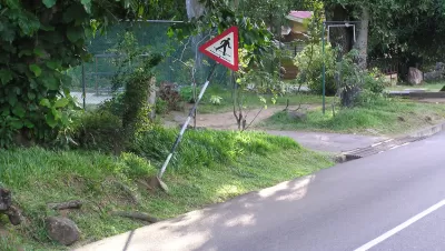
A report by Smart Growth America and the National Complete Streets Coalition ranked the danger to pedestrians in metro areas around the country. The report finds the metro areas of the Sun Belt are the least safe to be the least safe places to walk.
Sarah Goodyear shares the brutal statistics of a new report quantifying pedestrian safety in the United States. "Between 2003 and 2012, 47,025 pedestrians were killed by drivers in the United States. To put that in perspective, that’s 16 times the number of fatalities caused in the same period by the natural disasters – floods, tornadoes, hurricanes, and the like – that get so much more attention. An additional 676,000 were injured, the equivalent of one person every eight minutes."
The "Dangerous by Design 2014" [PDF] report by Smart Growth America and the National Complete Streets Coalition used the Pedestrian Danger Index (PDI) to quantify where pedestrians are most likely to get hit by a person driving a car.
As it has in the past, Florida dominates the top of the list, with the Orlando-Kissimmee metro area—the first of four in Florida to top the list, with a PDI of 244.28. The national average was 52.2.
On the flip side, the safest metro area was Boston-Cambridge-Quincy in Massachusetts, with a PDI of 18.65.
While acknowledging the difficulties inherent in changing such ingrained behavior, Florida officials said the right things after the report's release. "We want to change the culture, just as we did with the increased use of seat belts," said Billy Hattaway of the Florida Department of Transportation in a telebriefing on the report.
Alex Davies also reports on the study. In addition to focusing on the 20 metro areas at the top of the list, Davies contrasts the funding for "Transportation Alternatives" in the soon-to-expire MAP-21 transportation bill. The reauthorization bill passed by the Senate Environment and Public Works Committee last week "would provide funding through 2020, but maintain the current formulas for sharing that money." Ergo, "pedestrians would still lose out."
Goodyear also shares news of another relevant piece of federal legislation currently proposed in Congress, the Safe Streets Act of 2014. That bill would "require all states and Metropolitan Planning Organizations (MPO) to adopt complete street policies for federally funded projects within two years, and consider the safety of all users when designing new roads or improving existing roads."
Angie Schmitt also covered the report, identifying a few additional, salient trends worth noting from the report. For instance, in cities that had low PDIs, "walking is not only safer, it’s more widespread. In Boston, 15 percent of residents travel to work on foot. In Pittsburgh it’s 11.3 percent. That’s compared with less than 2 percent in Orlando." As for why that could be: "It’s not just that more people walk because it’s safer. The 'safety in numbers' effect may also help explain what’s going on — walking is safer in places with more pedestrians."
Then there is the type of street that is the biggest danger to pedestrians. Schmitt writes: "Arterial roadways — streets designed to collect traffic from smaller streets — are notoriously hostile to people walking. But they’re also difficult to avoid. A majority of pedestrian fatalities over the last decade — 52 percent — happened on arterial roads."
FULL STORY: The Most Dangerous U.S. Cities for Pedestrians


Milwaukee Launches Vision Zero Plan
Seven years after the city signed its Complete Streets Policy, the city is doubling down on its efforts to eliminate traffic deaths.

Vehicle-related Deaths Drop 29% in Richmond, VA
The seventh year of the city's Vision Zero strategy also cut the number of people killed in alcohol-related crashes by half.

Maryland Plans Quick-Build Complete Streets Projects
The state will use low-cost interventions to improve road safety in five Maryland counties.

Maui's Vacation Rental Debate Turns Ugly
Verbal attacks, misinformation campaigns and fistfights plague a high-stakes debate to convert thousands of vacation rentals into long-term housing.

Planetizen Federal Action Tracker
A weekly monitor of how Trump’s orders and actions are impacting planners and planning in America.

In Urban Planning, AI Prompting Could be the New Design Thinking
Creativity has long been key to great urban design. What if we see AI as our new creative partner?

King County Supportive Housing Program Offers Hope for Unhoused Residents
The county is taking a ‘Housing First’ approach that prioritizes getting people into housing, then offering wraparound supportive services.

Researchers Use AI to Get Clearer Picture of US Housing
Analysts are using artificial intelligence to supercharge their research by allowing them to comb through data faster. Though these AI tools can be error prone, they save time and housing researchers are optimistic about the future.

Making Shared Micromobility More Inclusive
Cities and shared mobility system operators can do more to include people with disabilities in planning and operations, per a new report.
Urban Design for Planners 1: Software Tools
This six-course series explores essential urban design concepts using open source software and equips planners with the tools they need to participate fully in the urban design process.
Planning for Universal Design
Learn the tools for implementing Universal Design in planning regulations.
planning NEXT
Appalachian Highlands Housing Partners
Mpact (founded as Rail~Volution)
City of Camden Redevelopment Agency
City of Astoria
City of Portland
City of Laramie