


New York City's MTA is gearing up to wire all of its subway stations for cellular use, and has released the full list of application concepts created by developers for subway riders. The public can vote now -- what would make your ride better?
"The public can flip through the list, see sample screen shots, video demos and imagine a world where a phone can guide a blind person through stations, read signage for you or generate a subway map that automatically changes with construction and weekend re-routing and know what restaurants and stores are right above your stop," writes Alex Goldmark.
Goldmark notes that many of the app ideas are workarounds for getting through the system without internet access, but there are also a few breakthrough ideas that will excite planners and regular passengers alike. For example, "BuzzJourney is a trip planner for people who want to mix it up between buses, carpooling, bike share and subways, because it might just be faster to plan to take a bus to bike share than sitting tight on the subway... The MetroNap App is for subterranean sleepers. It detects when a train is moving and figures out where you are so that it can wake you up at your stop."
Although the final decision on which apps to fund will be made by judges, the public can vote on its favorite ideas and the developer will receive a $1,000 prize.
FULL STORY: 49 New NYC Transit Apps Unveiled for 2013 MTA App Quest

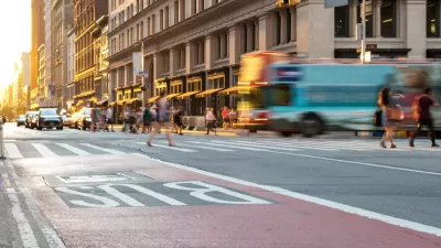
New York Officials Back Down on Bus Lane Plans
Proposed bus improvements in the Bronx are the latest casualty of opposition.

Fancy New Subway Cars Join the New York Subway System
New York has been planning on adding these new subway cars for years, finally achieving their goal in March 2023. More than a thousand of the new R211 trains will be running in New York within two years if all goes according to plan.

Changes to Local Service in the Bronx Benefit Bus Speeds, Ridership
Another example of how improving bus service design can benefit transit riders and transit systems emerges in New York City. More such local system redesigns are on the way soon in the Big Apple.

Planetizen Federal Action Tracker
A weekly monitor of how Trump’s orders and actions are impacting planners and planning in America.

Maui's Vacation Rental Debate Turns Ugly
Verbal attacks, misinformation campaigns and fistfights plague a high-stakes debate to convert thousands of vacation rentals into long-term housing.

Restaurant Patios Were a Pandemic Win — Why Were They so Hard to Keep?
Social distancing requirements and changes in travel patterns prompted cities to pilot new uses for street and sidewalk space. Then it got complicated.

In California Battle of Housing vs. Environment, Housing Just Won
A new state law significantly limits the power of CEQA, an environmental review law that served as a powerful tool for blocking new development.

Boulder Eliminates Parking Minimums Citywide
Officials estimate the cost of building a single underground parking space at up to $100,000.

Orange County, Florida Adopts Largest US “Sprawl Repair” Code
The ‘Orange Code’ seeks to rectify decades of sprawl-inducing, car-oriented development.
Urban Design for Planners 1: Software Tools
This six-course series explores essential urban design concepts using open source software and equips planners with the tools they need to participate fully in the urban design process.
Planning for Universal Design
Learn the tools for implementing Universal Design in planning regulations.
Heyer Gruel & Associates PA
JM Goldson LLC
Custer County Colorado
City of Camden Redevelopment Agency
City of Astoria
Transportation Research & Education Center (TREC) at Portland State University
Jefferson Parish Government
Camden Redevelopment Agency
City of Claremont