


In bright reds and oranges, a map produced by Data Driven Detroit makes clear how much the city has suffered from decades of suburban flight. Nearly every block of downtown features substantial parking, including a stunning amount of surface lots.

Thanks to the fine folks at Streetsblog for pointing us to Data Driven Detroit's stark map, which appeared on the satirical Facebook page Michigan Needs More Parking. "It shows downtown Detroit with parking highlighted in orange and red: garages in orange, surface lots in red," explains Angie Schmitt.
“We must do something about all of these non-parking blocks holding back Detroit,” Michigan Needs More Parking writes in their caption to the map. "The city is getting ready to decide whether to allow the demolition of a historic bank to make way for, you guessed it, more downtown parking," adds Schmitt.
Sadly, thanks to suburban flight and auto-centric planning and design, many cities across the U.S. could likely produce a similar-looking map.
FULL STORY: Parking vs. Everything Else: An Aerial Map of Downtown Detroit

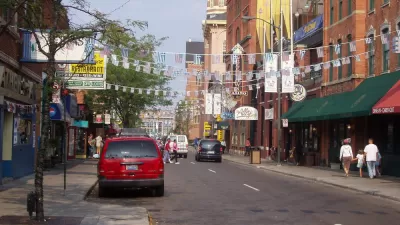
Detroit To Build New Parking for Small Businesses
The city will invest $9 million in an initiative to build customer parking on city-owned lots to boost economic development.

Businesses Oppose Conversion of Parking Structure Into Affordable Housing
Business owners in downtown Santa Monica have filed a lawsuit opposing the city's planned replacement of a parking structure with housing, despite city studies showing that the city's downtown parking supply far exceeds demand.

Watch: How to Remove Thousands of Parking Spaces
What the city of Amsterdam will gain by removing cars from on-street parking space.

Planetizen Federal Action Tracker
A weekly monitor of how Trump’s orders and actions are impacting planners and planning in America.

Restaurant Patios Were a Pandemic Win — Why Were They so Hard to Keep?
Social distancing requirements and changes in travel patterns prompted cities to pilot new uses for street and sidewalk space. Then it got complicated.

Map: Where Senate Republicans Want to Sell Your Public Lands
For public land advocates, the Senate Republicans’ proposal to sell millions of acres of public land in the West is “the biggest fight of their careers.”

Orange County, Florida Adopts Largest US “Sprawl Repair” Code
The ‘Orange Code’ seeks to rectify decades of sprawl-inducing, car-oriented development.

Maui's Vacation Rental Debate Turns Ugly
Verbal attacks, misinformation campaigns and fistfights plague a high-stakes debate to convert thousands of vacation rentals into long-term housing.

San Francisco Suspends Traffic Calming Amidst Record Deaths
Citing “a challenging fiscal landscape,” the city will cease the program on the heels of 42 traffic deaths, including 24 pedestrians.
Urban Design for Planners 1: Software Tools
This six-course series explores essential urban design concepts using open source software and equips planners with the tools they need to participate fully in the urban design process.
Planning for Universal Design
Learn the tools for implementing Universal Design in planning regulations.
Heyer Gruel & Associates PA
JM Goldson LLC
Custer County Colorado
City of Camden Redevelopment Agency
City of Astoria
Transportation Research & Education Center (TREC) at Portland State University
Camden Redevelopment Agency
City of Claremont
Municipality of Princeton (NJ)