


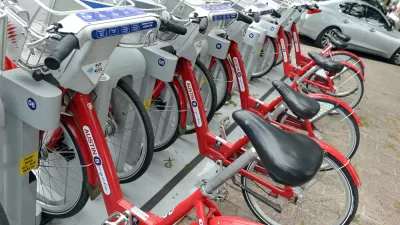
An interactive map from the bike-sharing consultancy Metrobike plots the world's active, proposed, and failed bike-sharing services. Willie Osterweil draws some interesting lessons from the data.
With information on everything from a program's start date to the size of its fleet and the operator, Metrobike's Bike-Sharing World Map is an incredible resource for those looking to stay up to date on the expanding world of bike-share. It also shows some interesting patterns in system distribution, says Osterwell. "The map has a lot of surprises: not only how far bike sharing has spread: from Auckland, New Zealand to Bandung, Indonesia to Baku, Azerbaijan, but also the vast number of Chinese bike-sharing programs."
"Another major takeaway from the image is just how far the US, Canada and the UK are behind Europe and Japan when it comes to bike-sharing."
"The map also shows that the US has many more proposed bike-sharing programs than successful ones: the question mark symbol (which indicates a proposed bike-share on the Bike-Sharing World Map) predominates in the US. As with most issues of sustainable public transportation options, the US is years behind Western Europe and Japan."
"For learning about bike-sharing either in depth or at a glance, the Bike-Sharing World Map is a tremendous resource"
FULL STORY: What Can We Learn from the Bike-Sharing World Map?

Transit, Bikeshare Integration Planned in Austin
Under a plan scheduled for implementation later this year, a transit pass will mean access to the city's bikeshare system.

Halloween Costumes for Urban Planners - 4th Edition
The fourth edition of our comprehensive list of amazing Halloween costumes for urban planners.
L.A. Bike-Share to Launch in April
This week, Southern California-based Bike Nation, a new player in the bike sharing business that has pledged $16 million toward L.A.'s first bike-share network, announced that the system will launch in April, just a year after it was announced.

Planetizen Federal Action Tracker
A weekly monitor of how Trump’s orders and actions are impacting planners and planning in America.

Map: Where Senate Republicans Want to Sell Your Public Lands
For public land advocates, the Senate Republicans’ proposal to sell millions of acres of public land in the West is “the biggest fight of their careers.”

Restaurant Patios Were a Pandemic Win — Why Were They so Hard to Keep?
Social distancing requirements and changes in travel patterns prompted cities to pilot new uses for street and sidewalk space. Then it got complicated.

Platform Pilsner: Vancouver Transit Agency Releases... a Beer?
TransLink will receive a portion of every sale of the four-pack.

Toronto Weighs Cheaper Transit, Parking Hikes for Major Events
Special event rates would take effect during large festivals, sports games and concerts to ‘discourage driving, manage congestion and free up space for transit.”

Berlin to Consider Car-Free Zone Larger Than Manhattan
The area bound by the 22-mile Ringbahn would still allow 12 uses of a private automobile per year per person, and several other exemptions.
Urban Design for Planners 1: Software Tools
This six-course series explores essential urban design concepts using open source software and equips planners with the tools they need to participate fully in the urban design process.
Planning for Universal Design
Learn the tools for implementing Universal Design in planning regulations.
Heyer Gruel & Associates PA
JM Goldson LLC
Custer County Colorado
City of Camden Redevelopment Agency
City of Astoria
Transportation Research & Education Center (TREC) at Portland State University
Camden Redevelopment Agency
City of Claremont
Municipality of Princeton (NJ)