


Humans are a noisy lot. In addition to fouling our cities with extreme sounds and exporting our din to wilderness areas, scientists are beginning to recognize and map the substantial impact of human-generated sound on the world's waters.
For years, we've been hearing about noise pollution threatening the quality of life in our cities and the supposed silence of remote landscapes. Lest we become deaf to the full impact of our own cacophony, "the federal government is completing the first phase of what could become one of the world’s largest efforts to curb the noise pollution and return the sprawling [undersea] ecosystem to a quieter state," reports William J. Broad. Ironically, some of the most significant components of that effort are visualizations of the audible world.
"The project, by the National Oceanic and Atmospheric Administration, seeks to document human-made noises in the ocean and transform the results into the world’s first large sound maps," writes Broad. "The ocean visualizations use bright colors to symbolize the sounds radiating out through the oceanic depths, frequently over distances of hundreds of miles."
"Michael Jasny, a senior policy analyst with the Natural Resources Defense Council, a private group in New York that has sued the Navy to reduce sounds that can harm marine mammals, praised the maps as 'magnificent' and their depictions of sound pollution as 'incredibly disturbing.'”
“We’ve been blind to it,” Mr. Jasny said in an interview. “The maps are enabling scientists, regulators and the public to visualize the problem. Once you see the pictures, the serious risk that ocean noise poses to the very fabric of marine life becomes impossible to ignore.”
"Legal experts say the new findings are likely to accelerate efforts both domestically and internationally to deal with the complicated problem through laws, regulations, treaties and voluntary noise reductions."
FULL STORY: A Rising Tide of Noise Is Now Easy to See

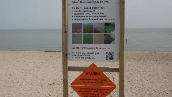
NOAA Great Lakes Lab Loses Key Funding
Cuts at a lab that monitors water quality in the Great Lakes region could harm efforts to prevent dangerous algal blooms.
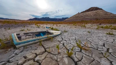
NOAA: Southwest ‘Megadrought’ to Persist
Roughly 40 percent of the 48 lower U.S. states are currently in some state of ‘abnormally dry conditions.’
NOAA Awards $575M in Coastal Resilience Grants
The program received over $16 billion in requests from communities around the country.

Planetizen Federal Action Tracker
A weekly monitor of how Trump’s orders and actions are impacting planners and planning in America.

Map: Where Senate Republicans Want to Sell Your Public Lands
For public land advocates, the Senate Republicans’ proposal to sell millions of acres of public land in the West is “the biggest fight of their careers.”

Restaurant Patios Were a Pandemic Win — Why Were They so Hard to Keep?
Social distancing requirements and changes in travel patterns prompted cities to pilot new uses for street and sidewalk space. Then it got complicated.

DC Area County Eliminates Bus Fares
Montgomery County joins a growing trend of making transit free.

Platform Pilsner: Vancouver Transit Agency Releases... a Beer?
TransLink will receive a portion of every sale of the four-pack.

Toronto Weighs Cheaper Transit, Parking Hikes for Major Events
Special event rates would take effect during large festivals, sports games and concerts to ‘discourage driving, manage congestion and free up space for transit.”
Urban Design for Planners 1: Software Tools
This six-course series explores essential urban design concepts using open source software and equips planners with the tools they need to participate fully in the urban design process.
Planning for Universal Design
Learn the tools for implementing Universal Design in planning regulations.
Heyer Gruel & Associates PA
JM Goldson LLC
Custer County Colorado
City of Camden Redevelopment Agency
City of Astoria
Transportation Research & Education Center (TREC) at Portland State University
Camden Redevelopment Agency
City of Claremont
Municipality of Princeton (NJ)