


Does your town have sensors embedded in the pavement of parking stalls that signal when one becomes available? D.C. and N.Y.C. do - and now Streetline's parking app will allow motorists in San Mateo, pop. 97K and San Carlos, pop. 28K to find parking.
Streetline's parker app should consider modifying the first sentence on its webpage from "Download Parker and easily find and pay for parking" to "and pay for parking, if there's a charge".
Bill Silverfarb writes that "San Mateo has 135 sensors spread over four blocks downtown that will be in place for a two-year demonstration period as the city embarks on a long-range mission to improve the downtown experience." Perhaps Streetline chose San Mateo because it is based in adjacent Foster City, CA. The free app was developed "in partnership with Cisco, the free app uses sensors embedded in the street to provide real-time parking availability". San Jose-based Cisco is located 30 miles to the south.
While parking in downtown San Mateo is metered both on-street and in garages, nearby San Carlos (5 miles south on the San Francisco Peninsula) does not charge for parking. However, like most smaller cities, San Carlos does set time limits, so the parking app's "self-timer that shows the amount of time left to park at that location" may prevent you from receiving a parking citation.
"Sensors that provide real-time data have been installed in approximately 100 parking spaces on the first three blocks of Laurel Street in downtown San Carlos," according to the city manager's press release.
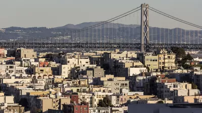
In addition to the two above Peninsula cities, Streetline's app will also be applied to the (metered) streets and garages of San Francisco, where sensors were installed as part of the innovative SF Park program, as Nate Berg explained in The Atlantic Cities last March:
"On-street parking spaces and city-owned garages are equipped with meters so the city can track occupancy rates and adjust pricing throughout the day. The city installed the system in 2010 and began varying its pricing last summer. The goal is to redistribute the demand for parking throughout the city. Web and phone applications make it easy for drivers to locate parking spots that are both open and at the desired price point."
Berg identifies many cities where Streetline's app is either in use or planned, but none as small as the two Peninsula cities described by Silverfarb.
FULL STORY: Parking gets easier


Lawsuits: Not Just for Development Opponents Anymore
Details of the "Sue the Suburbs" movement wielding a new legal tool to counteract the traditionally obstructionist methods of land use regulation in California.
Bay Area Planners Acknowledge the Need for Regional Housing Solutions
While most Bay Area communities are pursuing housing solutions "individually," local planners acknowledge the need for strategies that address the regional as a unified whole.
MonkeyParking App Is Back—This Time It's Legal
The infamous MonkeyParking app that last year ran afoul of public sentiment and the law is back with a new business model that offers residents the chance to auction that most precious of commodities—urban parking space.

Planetizen Federal Action Tracker
A weekly monitor of how Trump’s orders and actions are impacting planners and planning in America.

Restaurant Patios Were a Pandemic Win — Why Were They so Hard to Keep?
Social distancing requirements and changes in travel patterns prompted cities to pilot new uses for street and sidewalk space. Then it got complicated.

Map: Where Senate Republicans Want to Sell Your Public Lands
For public land advocates, the Senate Republicans’ proposal to sell millions of acres of public land in the West is “the biggest fight of their careers.”

Maui's Vacation Rental Debate Turns Ugly
Verbal attacks, misinformation campaigns and fistfights plague a high-stakes debate to convert thousands of vacation rentals into long-term housing.

San Francisco Suspends Traffic Calming Amidst Record Deaths
Citing “a challenging fiscal landscape,” the city will cease the program on the heels of 42 traffic deaths, including 24 pedestrians.

California Homeless Arrests, Citations Spike After Ruling
An investigation reveals that anti-homeless actions increased up to 500% after Grants Pass v. Johnson — even in cities claiming no policy change.
Urban Design for Planners 1: Software Tools
This six-course series explores essential urban design concepts using open source software and equips planners with the tools they need to participate fully in the urban design process.
Planning for Universal Design
Learn the tools for implementing Universal Design in planning regulations.
Heyer Gruel & Associates PA
JM Goldson LLC
Custer County Colorado
City of Camden Redevelopment Agency
City of Astoria
Transportation Research & Education Center (TREC) at Portland State University
Camden Redevelopment Agency
City of Claremont
Municipality of Princeton (NJ)