


The League of American Bicyclists updated their webpage with a link to the American Community Survey's data on bike and pedestrian commuting for the 70 largest cities and 375 more cities where data was available. Portland, OR and Davis, CA are tops.
The estimated data is from the 2010 Census and can be sorted to easily find a particular city (if it was over 65,000 in population and had data available). While the average bike commute rate in 2010 in the U.S. is .53%, it represents a 40% increase from 2010. Only 'bike/walk-to-work' trips are listed - total biking and walking trips are much greater. Two spreadsheets are described and linked below.
"A look at the country's 70 largest cities shows that the communities that have done the most to promote bicycling through engineering, education, encouragement, enforcement, and evaluation – determined by the League's Bicycle Friendly America program – have seen greater increases in bike commuting over the past decade than non-Bicycle Friendly Communities.
Portland was highest with 6% commuting by bike, followed by Seattle with 3.6%, and San Francisco and Minneapolis at 3.5%.
A look at the 2010 Bike Commuter Statistics for 375 cities shows the college towns of Davis, CA at 22.1%, followed by Boulder, CO at 9.9%, and Eugene, OR at 8.3%.
The multi-column data on both tables (70 cities and 375 cities) can be sorted by using the "click to edit" function on the top right.
FULL STORY: 2010 Bike Commuting Data Released

College Towns Provide a Master Class in Bike-Friendliness
New data from the U.S. Census Bureau shows that college towns are even better at encouraging bicycle commuting than the most notable big cities (Portland, Seattle, etc); even when excluding commuting for school. What's their secret?

Mapping the Pacific Northwest's Changing Population
The Oregonian has published a new interactive mapping feature that allows users to map demographic changes to the Census tract level through Oregon and Washington.
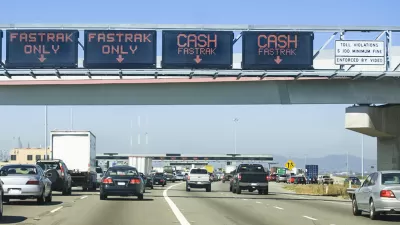
Analysis Debunks Equity Criticism of Congestion Pricing
Oregon's recently approved gas tax legislation also calls for tolling of I-205 and I-5 in the Portland metro area, with the application of value or congestion pricing so peak period tolls would be higher, which have raised equity concerns.

Planetizen Federal Action Tracker
A weekly monitor of how Trump’s orders and actions are impacting planners and planning in America.

Chicago’s Ghost Rails
Just beneath the surface of the modern city lie the remnants of its expansive early 20th-century streetcar system.

San Antonio and Austin are Fusing Into one Massive Megaregion
The region spanning the two central Texas cities is growing fast, posing challenges for local infrastructure and water supplies.

Since Zion's Shuttles Went Electric “The Smog is Gone”
Visitors to Zion National Park can enjoy the canyon via the nation’s first fully electric park shuttle system.

Trump Distributing DOT Safety Funds at 1/10 Rate of Biden
Funds for Safe Streets and other transportation safety and equity programs are being held up by administrative reviews and conflicts with the Trump administration’s priorities.

German Cities Subsidize Taxis for Women Amid Wave of Violence
Free or low-cost taxi rides can help women navigate cities more safely, but critics say the programs don't address the root causes of violence against women.
Urban Design for Planners 1: Software Tools
This six-course series explores essential urban design concepts using open source software and equips planners with the tools they need to participate fully in the urban design process.
Planning for Universal Design
Learn the tools for implementing Universal Design in planning regulations.
planning NEXT
Appalachian Highlands Housing Partners
Mpact (founded as Rail~Volution)
City of Camden Redevelopment Agency
City of Astoria
City of Portland
City of Laramie