


The "secret boulevard," running between 6th and 7th Avenues in Manhattan through atrias, arcades, and public plazas from 51st Street to 57th Street, is getting attention and an upgrade from the Department of Transportation, reports Matt Chaban.
The cut-through, already used by thousands of pedestrians a day, was created as "a quirk in the zoning" as dictated by Privately Owned Public Spaces (POPS) incentives utilized as the blocks developed in the 1970s. Now the DOT, led by Janette Sadik-Khan, is looking to formalize the pathway, providing "a new pedestrian avenue in the heart of Midtown, one of the densest, busiest places on Earth."
Chaban documents the incremental changes being proposed by the DOT, that will create "a series of traffic interventions to link up these disparate shortcuts."
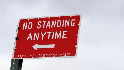
"The plan calls for creating new pedestrian crossings between these public spaces, which generally are directly across the street from one another. Stop signs will be installed in front of new raised crosswalks. Warning markings-BUMP, STOP, chevrons and stripes-will all alert drivers to the new intersection while curbed cuts and painted street space will make crossing easier and prohibit parking."
Chaban also discusses the genesis of the project, which was initiated not by the DOT, but by "a ragtag band of planners, architects and urban obsessive."
"It was Friends of POPS that first came up with the idea of connecting these spaces, which the group dubbed Holly White Way, in honor of the influential planner and public spaces advocate who championed the creation and regulation of POPS."
The plan was approved this week by the Community Board 5 Transportation Committee, and moves to the full board on April 12th.
"'It's $60,000 to do all of this?' David Grider, an architect and chairman of Friends of POPS, said after the vote. 'It's wonderful. It just seems like very responsible low-hanging fruit.'"
FULL STORY: Meet Me on 6½th Avenue: DOT Planning Public Promenade Through Middle of Midtown Towers

Open Street Abandoned in New York
The New York Department of Transportation is changing the way it plans and manages open streets as political support for the concept wavers.
Miracle on 14th Street
Predictions of carmageddon have not come to pass after New York City blocked most car traffic of a section of 14th Street in Manhattan to make way for buses.
Early Reviews for New York's Big Car-Free Experiment
Last week, 14th Street in Manhattan was closed to almost all varieties of automobile traffic, freeing up one of the slowest bus routes in the city. How will residents, workers, and commuters react?

Planetizen Federal Action Tracker
A weekly monitor of how Trump’s orders and actions are impacting planners and planning in America.

Maui's Vacation Rental Debate Turns Ugly
Verbal attacks, misinformation campaigns and fistfights plague a high-stakes debate to convert thousands of vacation rentals into long-term housing.

San Francisco Suspends Traffic Calming Amidst Record Deaths
Citing “a challenging fiscal landscape,” the city will cease the program on the heels of 42 traffic deaths, including 24 pedestrians.

Defunct Pittsburgh Power Plant to Become Residential Tower
A decommissioned steam heat plant will be redeveloped into almost 100 affordable housing units.

Trump Prompts Restructuring of Transportation Research Board in “Unprecedented Overreach”
The TRB has eliminated more than half of its committees including those focused on climate, equity, and cities.

Amtrak Rolls Out New Orleans to Alabama “Mardi Gras” Train
The new service will operate morning and evening departures between Mobile and New Orleans.
Urban Design for Planners 1: Software Tools
This six-course series explores essential urban design concepts using open source software and equips planners with the tools they need to participate fully in the urban design process.
Planning for Universal Design
Learn the tools for implementing Universal Design in planning regulations.
Heyer Gruel & Associates PA
JM Goldson LLC
Custer County Colorado
City of Camden Redevelopment Agency
City of Astoria
Transportation Research & Education Center (TREC) at Portland State University
Jefferson Parish Government
Camden Redevelopment Agency
City of Claremont