


Samuel Arbesman pens a fascinating piece in The Atlantic Cities analyzing our subjective concepts of scale and context in relation to our ideas about the importance and size of cities.
Using fairly simple graphic models, Arbesman prods at the misconceptions about the scale of cities and the relationship of population size to importance, using the example of his new home, Kansas City, Missouri.
Considered a fairly small city to most people, Arbesman's notes in a simple, yet compelling graphic that, "Kansas City would be the second-largest city in France. Similarly, many European cities that we think of being incredibly important and central to global affairs are not as large as they feature in our minds. Dublin, Amsterdam, and Brussels are all smaller than Cleveland, for example."
Going further, Arbesman makes some surprising comparisons: "Did you know, for instance, that the unoccupied section of Detroit is actually the size of the entire city of San Francisco. Or that the size of Greater Tokyo would take up a significant portion of England. Or even that the area of ancient Rome is fourteen times smaller than the area of the city of Rome, New York."
While relativity (historical, economic, cultural, etc.) sets the stage for our preconceptions about cities it also provides the basis for breaking down those preconceptions. "So don't be concerned if your city seems somewhat ordinary. Mediocrity is only mediocrity in comparison to those immediately around you."
FULL STORY: How Big Is Your City, Really?


A Brief History of Kansas City’s Microtransit
The city’s costly experiment with on-demand transit is yielding to more strategic investment.
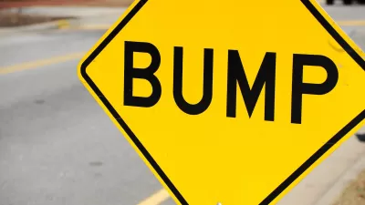
Kansas City Adding Speed Bumps for Traffic Safety
The city is adding the traffic calming measures at 50 high-risk intersections.
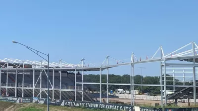
New Kansas City Stadium Offers Limited Parking
Unlike many sports arenas surrounded by seas of concrete, the new CPKC Stadium has parking for just 2,000 vehicles, hoping most sports fans will arrive by transit.

Planetizen Federal Action Tracker
A weekly monitor of how Trump’s orders and actions are impacting planners and planning in America.

Map: Where Senate Republicans Want to Sell Your Public Lands
For public land advocates, the Senate Republicans’ proposal to sell millions of acres of public land in the West is “the biggest fight of their careers.”

Restaurant Patios Were a Pandemic Win — Why Were They so Hard to Keep?
Social distancing requirements and changes in travel patterns prompted cities to pilot new uses for street and sidewalk space. Then it got complicated.

Platform Pilsner: Vancouver Transit Agency Releases... a Beer?
TransLink will receive a portion of every sale of the four-pack.

Toronto Weighs Cheaper Transit, Parking Hikes for Major Events
Special event rates would take effect during large festivals, sports games and concerts to ‘discourage driving, manage congestion and free up space for transit.”

Berlin to Consider Car-Free Zone Larger Than Manhattan
The area bound by the 22-mile Ringbahn would still allow 12 uses of a private automobile per year per person, and several other exemptions.
Urban Design for Planners 1: Software Tools
This six-course series explores essential urban design concepts using open source software and equips planners with the tools they need to participate fully in the urban design process.
Planning for Universal Design
Learn the tools for implementing Universal Design in planning regulations.
Heyer Gruel & Associates PA
JM Goldson LLC
Custer County Colorado
City of Camden Redevelopment Agency
City of Astoria
Transportation Research & Education Center (TREC) at Portland State University
Camden Redevelopment Agency
City of Claremont
Municipality of Princeton (NJ)