


Emily Badger explores the art of environmental graphic design, or wayfinding, and what it takes to strike the right balance between intuitive navigation and individual discovery.
Badger makes a distinction between intuitive older European cities and complex contemporary cities that require guidance to navigate, and the often subconscious ways in which wayfinding should operate on the latter.
"Architectural signage and wayfinding isn't about building a nicely designed sign," says Sue Labouvie, one such expert whom we tapped to explain the science of helping us find our way in the city. "It's about the information content and the analysis of the space or place that you're trying to move people through, and coming up with a strategy of how you make this big complex thing simple and understandable to the user."
FULL STORY: The Surprisingly Complex Art of Urban Wayfinding

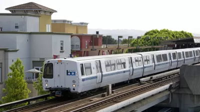
California Bill Would Mandate Seamless Transit
With 27 transit agencies, traveling across the Bay Area can be a daunting task. Advocates for 'seamless transit' want to change that.
Pittsburgh Pedestrian Wayfinding Program Set to Launch
Southwestern Pennsylvania Commission awarded $1.4 million to the city of Pittsburgh to launch the Pittsburgh Pedestrian Wayfinding initiative.
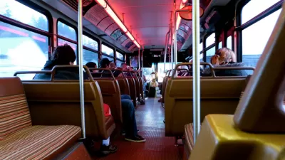
'OK Google, How Crowded is the Number 8 Bus?'
Google Maps will now share data about how crowded buses and trains are likely to be.

Planetizen Federal Action Tracker
A weekly monitor of how Trump’s orders and actions are impacting planners and planning in America.

Map: Where Senate Republicans Want to Sell Your Public Lands
For public land advocates, the Senate Republicans’ proposal to sell millions of acres of public land in the West is “the biggest fight of their careers.”

Restaurant Patios Were a Pandemic Win — Why Were They so Hard to Keep?
Social distancing requirements and changes in travel patterns prompted cities to pilot new uses for street and sidewalk space. Then it got complicated.

Platform Pilsner: Vancouver Transit Agency Releases... a Beer?
TransLink will receive a portion of every sale of the four-pack.

Toronto Weighs Cheaper Transit, Parking Hikes for Major Events
Special event rates would take effect during large festivals, sports games and concerts to ‘discourage driving, manage congestion and free up space for transit.”

Berlin to Consider Car-Free Zone Larger Than Manhattan
The area bound by the 22-mile Ringbahn would still allow 12 uses of a private automobile per year per person, and several other exemptions.
Urban Design for Planners 1: Software Tools
This six-course series explores essential urban design concepts using open source software and equips planners with the tools they need to participate fully in the urban design process.
Planning for Universal Design
Learn the tools for implementing Universal Design in planning regulations.
Heyer Gruel & Associates PA
JM Goldson LLC
Custer County Colorado
City of Camden Redevelopment Agency
City of Astoria
Transportation Research & Education Center (TREC) at Portland State University
Camden Redevelopment Agency
City of Claremont
Municipality of Princeton (NJ)