


Arlington, Virginia is using housing and redevelopment to repair the superblock-dominated street grid of Crystal City.
Arlington has embarked on a redevelopment plan that will accommodate significant new growth in housing units and office space that will transform Crystal City's 60s era superblocks into a more coherent, vibrant pedestrian network.
The recently adopted Crystal City Sector Plan generally proposes to guide future redevelopment in Crystal City to break down the superblocks into a more traditional neighborhood development pattern by converting one-way streets to two-way streets and creating new streets through redevelopment to create a more refined urban street grid.
From the Under One Roof blog: "In addition to street improvements, key land use and urban design changes in vertical building form can also play a role. For instance, instead of the towers in the park typology that characterizes much of Crystal City today, more mid- and high-rise buildings can be placed at the back of sidewalk and oriented to have their building facades (on at least two sides) help to frame and create the urban spaces that comprise the neighborhood's streets, parks, and plazas."
Thanks to Andrew D'huyvetter
FULL STORY: Repairing Superblocks through Redevelopment


Office Conversions Have Increased Every Year This Decade
Since the pandemic, office vacancy rates remain high, leading many cities to adjust zoning codes to accommodate adaptive reuse.
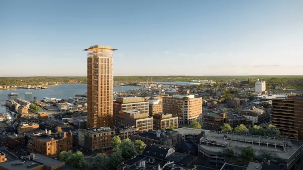
Downtown Portland Ready for Maine's Tallest Building
The city of Portland anticipates a major new urban development addition called the “Old Port Square” project.

The Simple Legislative Tool Transforming Vacant Downtowns
In California, Michigan and Georgia, an easy win is bringing dollars — and delight — back to city centers.

Planetizen Federal Action Tracker
A weekly monitor of how Trump’s orders and actions are impacting planners and planning in America.

Map: Where Senate Republicans Want to Sell Your Public Lands
For public land advocates, the Senate Republicans’ proposal to sell millions of acres of public land in the West is “the biggest fight of their careers.”

Restaurant Patios Were a Pandemic Win — Why Were They so Hard to Keep?
Social distancing requirements and changes in travel patterns prompted cities to pilot new uses for street and sidewalk space. Then it got complicated.

Platform Pilsner: Vancouver Transit Agency Releases... a Beer?
TransLink will receive a portion of every sale of the four-pack.

Toronto Weighs Cheaper Transit, Parking Hikes for Major Events
Special event rates would take effect during large festivals, sports games and concerts to ‘discourage driving, manage congestion and free up space for transit.”

Berlin to Consider Car-Free Zone Larger Than Manhattan
The area bound by the 22-mile Ringbahn would still allow 12 uses of a private automobile per year per person, and several other exemptions.
Urban Design for Planners 1: Software Tools
This six-course series explores essential urban design concepts using open source software and equips planners with the tools they need to participate fully in the urban design process.
Planning for Universal Design
Learn the tools for implementing Universal Design in planning regulations.
Heyer Gruel & Associates PA
JM Goldson LLC
Custer County Colorado
City of Camden Redevelopment Agency
City of Astoria
Transportation Research & Education Center (TREC) at Portland State University
Camden Redevelopment Agency
City of Claremont
Municipality of Princeton (NJ)