


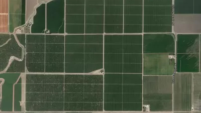
The U.S. Geological Survey has released a highly detailed map of vegetative land-cover in America, which is expected to assist officials in efforts to preserve wildlife habitats.
The map is available online and also shows the extent of human land-use in the U.S.
"The GAP national land cover data, based on the NatureServe Ecological Systems Classification, is the most detailed, consistent map of vegetative associations ever available for the United States and will help facilitate the planning and management of biological diversity on a regional and national scale.
...The final version of the landcover map contains 551 Ecological Systems and modified Ecological Systems (the modified ecological systems represent 32 land use classes which depict developed and/or disturbed land cover classes). The map combines data from previous GAP projects in the Southwest, Southeast, and Northwest United States with recently updated California data. For areas of the continental United States where ecological system-level GAP data has not yet been developed, data from the LANDFIRE project compiled by Landscope was used. This allows for the construction of a seamless representation of ecological system distributions across the continental United States."
FULL STORY: First detailed national map of land-cover vegetation released


How the National Park Service Uses GIS
A new book demonstrates how the National Park Service uses GIS technology to meet its mission and showcases a selection of maps used for effectively managing national parks.
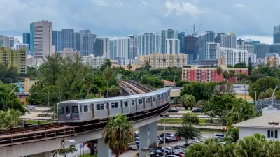
New Tool Puts Miami Development Opportunities on the Map
There's plenty of vacant or underutilized land to be found in Miami-Dade County, if you know where and how to look.
Facebook AI Maps Population Density
Facebook expects to release its worldwide maps of human density in the coming months—potential applications will likely be somewhere on the spectrum between humanitarian and commercial.

Planetizen Federal Action Tracker
A weekly monitor of how Trump’s orders and actions are impacting planners and planning in America.

San Francisco's School District Spent $105M To Build Affordable Housing for Teachers — And That's Just the Beginning
SFUSD joins a growing list of school districts using their land holdings to address housing affordability challenges faced by their own employees.

The Tiny, Adorable $7,000 Car Turning Japan Onto EVs
The single seat Mibot charges from a regular plug as quickly as an iPad, and is about half the price of an average EV.

Seattle's Plan for Adopting Driverless Cars
Equity, safety, accessibility and affordability are front of mind as the city prepares for robotaxis and other autonomous vehicles.

As Trump Phases Out FEMA, Is It Time to Flee the Floodplains?
With less federal funding available for disaster relief efforts, the need to relocate at-risk communities is more urgent than ever.

With Protected Lanes, 460% More People Commute by Bike
For those needing more ammo, more data proving what we already knew is here.
Urban Design for Planners 1: Software Tools
This six-course series explores essential urban design concepts using open source software and equips planners with the tools they need to participate fully in the urban design process.
Planning for Universal Design
Learn the tools for implementing Universal Design in planning regulations.
Smith Gee Studio
City of Charlotte
City of Camden Redevelopment Agency
City of Astoria
Transportation Research & Education Center (TREC) at Portland State University
US High Speed Rail Association
City of Camden Redevelopment Agency
Municipality of Princeton (NJ)