


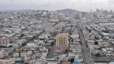
Variable parking rates and online parking availability are features of a pilot program meant to increase convenience and cut congestion on the road.
San Francisco hopes a pilot program linking parking spaces in the city with sophisticated metering will help reduce the amount of time drivers spend looking for parking, while unclogging streets and reducing auto emissions.
The project won't increase the parking supply - as the city's long-standing policy is to reduce reliance on cars - but the goal is to cut the time it takes drivers to find parking by micromanaging spaces.
"As SFpark is envisioned, parking rates would be adjusted based on time of day, day of week and duration of stay. People would be able to pay not just with coins, but with credit cards, prepaid debit cards and even by cell phone. If a meter is set to expire, a text message could be sent to the driver. More time could be purchased remotely."
"People also would be able to check parking availability before arriving at their destination via the Internet, handheld devices such as BlackBerrys, or cell phone. Sensors would be embedded in the asphalt to keep track of when a parking spot is empty."
"The technology isn't new, but San Francisco would be the first American city to apply it on such a broad scale. That's one reason federal transportation authorities took an interest and decided to help pay for the experiment." The federal government will be paying $18 million of the project's $23 million budget.
"'The idea is to give people more choice, more convenience and to reduce congestion,' said Mayor Gavin Newsom."
Thanks to Andy J. Wang
FULL STORY: SFpark would micromanage city's scarce spaces

San Francisco's Running Out of Room for Cars
In terms of land area, San Francisco’s a small city. Yet if current policies persist, the city will build 92,000 parking spots for residents by 2040, on just 49 square miles of land.
San Francisco's Performance Parking Pilot Less Successful Than Hoped
In San Francisco, a performance parking pilot program has not had as big an impact as many thought it would. According to Michael Perkins, "Even with high rates, popular blocks still fill up, and other blocks remain under-filled even at low prices."
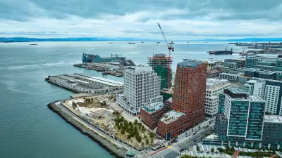
San Francisco Development Centers Pedestrians, Public Space
The Mission Rock project eliminates street parking, replacing it with public seating and landscaping.

Maui's Vacation Rental Debate Turns Ugly
Verbal attacks, misinformation campaigns and fistfights plague a high-stakes debate to convert thousands of vacation rentals into long-term housing.

Planetizen Federal Action Tracker
A weekly monitor of how Trump’s orders and actions are impacting planners and planning in America.

Chicago’s Ghost Rails
Just beneath the surface of the modern city lie the remnants of its expansive early 20th-century streetcar system.

Bend, Oregon Zoning Reforms Prioritize Small-Scale Housing
The city altered its zoning code to allow multi-family housing and eliminated parking mandates citywide.

Amtrak Cutting Jobs, Funding to High-Speed Rail
The agency plans to cut 10 percent of its workforce and has confirmed it will not fund new high-speed rail projects.

LA Denies Basic Services to Unhoused Residents
The city has repeatedly failed to respond to requests for trash pickup at encampment sites, and eliminated a program that provided mobile showers and toilets.
Urban Design for Planners 1: Software Tools
This six-course series explores essential urban design concepts using open source software and equips planners with the tools they need to participate fully in the urban design process.
Planning for Universal Design
Learn the tools for implementing Universal Design in planning regulations.
planning NEXT
Appalachian Highlands Housing Partners
Mpact (founded as Rail~Volution)
City of Camden Redevelopment Agency
City of Astoria
City of Portland
City of Laramie