


After reading through dozens of long range transportation plans, I have to wonder if the planning profession is serious about improving mobility. By mobility, I mean improving the ability, speed, and efficiency of getting from point A to point B.

After reading through dozens of long range transportation plans, I have to wonder if the planning profession is serious about improving mobility. By mobility, I mean improving the ability, speed, and efficiency of getting from point A to point B.
This isn't the focus of most plans. On the contrary. These plans seemed focused on reducing mobility. Few, for example, recognize let alone make recommendations for reducing traffic congestion. In fact, David Hartgen at the University of North Carolina-Charlotte estimates that more than 40% of the American population will live in metropolitan areas with severe congestion (LOS F) by 2030 based on current trends and transportation plans. Twelve cities will have congestion equivalent to current day Los Angeles.
Instead, the programmatic focus of most Long Range Transportation Plans seems to be on: 1) improving options for small groups that use alternative transportation modes, such as bicycles, but have little overall impact on traffic patterns or regional mobility, 2) attempting to funnel more people onto public transit which usually results in longer commutes and trips, or 3) reducing travel overall (which of course reduces mobility).
At the core, it seems, improving mobility in the 21st century implies accepting, even embracing auto-mobility. This, of course, means planning for the car. Perhaps that's the real problem: the planning profession has yet to really accept and embrace the automobile as a fundamental step forward in improving mobility. Until it does that, and incorporates this view into long range transportation plans, we seem committed to less mobility and more congestion.


Opinion: Transportation Funding Priorities Are Outdated
Investing in technology and promoting innovation in the transportation sector can further the Biden administration's goals of reducing carbon emissions and improving public transit.
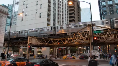
Ride-Hailing Report Examines Effects on Chicago's Congestion
A new report looks at how the increase of ride-hailing in Chicago is affecting infrastructure and mobility.
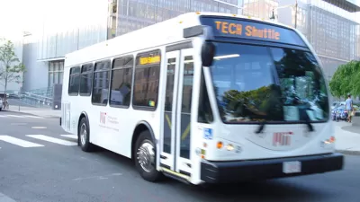
Tech Shuttles: The Bay Area's Seventh Largest Transportation Provider
A new survey has found that every day more than 800 tech buses are traveling on the region's roadways, carrying around 34,000 passengers daily

Planetizen Federal Action Tracker
A weekly monitor of how Trump’s orders and actions are impacting planners and planning in America.

Map: Where Senate Republicans Want to Sell Your Public Lands
For public land advocates, the Senate Republicans’ proposal to sell millions of acres of public land in the West is “the biggest fight of their careers.”

Restaurant Patios Were a Pandemic Win — Why Were They so Hard to Keep?
Social distancing requirements and changes in travel patterns prompted cities to pilot new uses for street and sidewalk space. Then it got complicated.

Platform Pilsner: Vancouver Transit Agency Releases... a Beer?
TransLink will receive a portion of every sale of the four-pack.

Toronto Weighs Cheaper Transit, Parking Hikes for Major Events
Special event rates would take effect during large festivals, sports games and concerts to ‘discourage driving, manage congestion and free up space for transit.”

Berlin to Consider Car-Free Zone Larger Than Manhattan
The area bound by the 22-mile Ringbahn would still allow 12 uses of a private automobile per year per person, and several other exemptions.
Urban Design for Planners 1: Software Tools
This six-course series explores essential urban design concepts using open source software and equips planners with the tools they need to participate fully in the urban design process.
Planning for Universal Design
Learn the tools for implementing Universal Design in planning regulations.
Heyer Gruel & Associates PA
JM Goldson LLC
Custer County Colorado
City of Camden Redevelopment Agency
City of Astoria
Transportation Research & Education Center (TREC) at Portland State University
Camden Redevelopment Agency
City of Claremont
Municipality of Princeton (NJ)