


Esri's new ACS Atlas Collection offers interactive applications that visualize the latest U.S. demographic and socio-economic data, enabling users to explore over 175 curated web maps across various thematic areas.
Esri's ArcGIS Living Atlas team has unveiled the American Community Survey (ACS) Atlas Collection, a suite of interactive applications designed to visualize the latest 2019-2023 ACS 5-year estimates from the U.S. Census Bureau. As reported by Laura Phoebus, this collection comprises five Atlas Instant Apps, each focusing on thematic areas such as Demographics, Social Characteristics, Economic Characteristics, and Housing. Users can explore over 175 web maps addressing various topics, including age, race, income, education, and employment, providing a comprehensive view of community trends across the United States.
The Atlas Instant Apps offer an engaging platform for users to interact with ACS data. Features include browsing and filtering maps by different categories, navigating through bookmarks, and capturing screenshots complete with legends and pop-ups. Additionally, users with ArcGIS Online accounts can save personalized copies of maps, create StoryMaps, or develop other Instant Apps directly from the Atlas interface. This functionality ensures that both novice and experienced GIS professionals can effectively utilize the ACS data for analysis and storytelling.
The ACS Atlas Collection aims to empower the GIS community by providing intuitive tools to explore and uncover new trends within curated map collections. By leveraging the ArcGIS Atlas Instant App template, Esri facilitates a more interactive and accessible means of discovering content derived from the ACS. This initiative not only enhances the user experience but also promotes informed decision-making based on the latest demographic and socio-economic data available.
FULL STORY: Introducing the American Community Survey (ACS) Atlas Collection

Choosing Ignorance is Stupid
People love statistics. They let us understanding the world beyond our own senses. USA Today publishes a daily Snapshot which presents a graph of random statistics. Sports talk and business analysis are dominated by statistics. We measure our progress, or lack thereof, and compare ourselves with others, based on statistics about our size, activities and accomplishments.
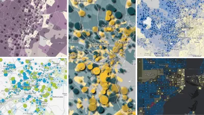
Mapping the Nation's Well-Being
Who's the happiest and healthiest of them all? The New York Times posts an interactive map of the national Gallup-Healthways Well-Being Index.

How Data-Driven Research Is Shaping Sustainable Urban Development
Explore how data-driven research is revolutionizing sustainable urban development, creating smarter, greener, and more resilient cities for the future.

Planetizen Federal Action Tracker
A weekly monitor of how Trump’s orders and actions are impacting planners and planning in America.

Congressman Proposes Bill to Rename DC Metro “Trump Train”
The Make Autorail Great Again Act would withhold federal funding to the system until the Washington Metropolitan Area Transit Authority (WMATA), rebrands as the Washington Metropolitan Authority for Greater Access (WMAGA).

The Simple Legislative Tool Transforming Vacant Downtowns
In California, Michigan and Georgia, an easy win is bringing dollars — and delight — back to city centers.

The States Losing Rural Delivery Rooms at an Alarming Pace
In some states, as few as 9% of rural hospitals still deliver babies. As a result, rising pre-term births, no adequate pre-term care and harrowing close calls are a growing reality.

The Small South Asian Republic Going all in on EVs
Thanks to one simple policy change less than five years ago, 65% of new cars in this Himalayan country are now electric.

DC Backpedals on Bike Lane Protection, Swaps Barriers for Paint
Citing aesthetic concerns, the city is removing the concrete barriers and flexposts that once separated Arizona Avenue cyclists from motor vehicles.
Urban Design for Planners 1: Software Tools
This six-course series explores essential urban design concepts using open source software and equips planners with the tools they need to participate fully in the urban design process.
Planning for Universal Design
Learn the tools for implementing Universal Design in planning regulations.
Smith Gee Studio
City of Charlotte
City of Camden Redevelopment Agency
City of Astoria
Transportation Research & Education Center (TREC) at Portland State University
US High Speed Rail Association
City of Camden Redevelopment Agency
Municipality of Princeton (NJ)