


The City Nature Challenge invites people worldwide to document urban biodiversity by photographing and sharing wild plants and animals through the iNaturalist app, helping scientists track and understand real-time changes in ecosystems.
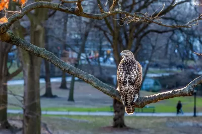
The City Nature Challenge is a global event happening from April 25 to April 28, 2025, inviting individuals of all ages and backgrounds to explore and document the wild plants, animals, and fungi in their surroundings. This initiative aims to engage community scientists, nature enthusiasts, and everyday observers to contribute to tracking real-time biodiversity changes. By sharing photographs of wildlife, participants help scientists better understand the planet’s ecosystems and advance wildlife conservation efforts.
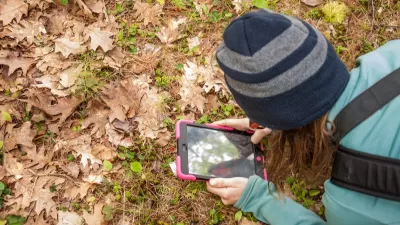
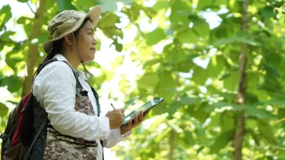
Participation is simple and starts at home. Observers can explore their homes, backyards, or neighborhoods to find wild plants, insects, or animals—whether it is a bird on a powerline, a weed sprouting in the yard, or an insect scurrying under leaves. Local parks also provide excellent opportunities to discover different species by checking grass, plants, benches, and trees. Safety is paramount, so participants are encouraged to be mindful of their surroundings when exploring and documenting wildlife.
To join, download the iNaturalist app and follow four easy steps: locate wildlife in your area, take photos of wild plants and animals, share your findings through the app, and engage with the community as your observations are identified. Remember to mark anything planted or cared for by people as “captive” or “cultivated” to ensure accurate data. By participating in the City Nature Challenge, you will not only contribute to global biodiversity research but also gain a deeper appreciation for the natural world around you.
FULL STORY: 2025 City Nature Challenge

Detecting Invasive Species Early Through Citizen Science
Community science platforms like eBird and iNaturalist enhance early detection of invasive species, complementing professional surveillance and highlighting the need for stronger collaboration between the public and official authorities.
Discovering LA’s Biodiversity: The 2024 BioBlitz Challenge
The BioBlitz Challenge invites participants to document local wildlife throughout October using the iNaturalist app, contributing to conservation efforts and scientific research on Los Angeles' biodiversity.
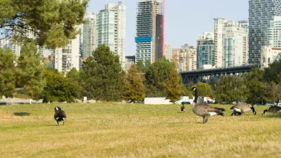
Study: How Urban Parks Can Support Biodiversity
Conservation and recreation can go hand in hand in urban green spaces designed to serve both humans and local wildlife.

Planetizen Federal Action Tracker
A weekly monitor of how Trump’s orders and actions are impacting planners and planning in America.

San Francisco's School District Spent $105M To Build Affordable Housing for Teachers — And That's Just the Beginning
SFUSD joins a growing list of school districts using their land holdings to address housing affordability challenges faced by their own employees.

The Tiny, Adorable $7,000 Car Turning Japan Onto EVs
The single seat Mibot charges from a regular plug as quickly as an iPad, and is about half the price of an average EV.

Seattle's Plan for Adopting Driverless Cars
Equity, safety, accessibility and affordability are front of mind as the city prepares for robotaxis and other autonomous vehicles.

As Trump Phases Out FEMA, Is It Time to Flee the Floodplains?
With less federal funding available for disaster relief efforts, the need to relocate at-risk communities is more urgent than ever.

With Protected Lanes, 460% More People Commute by Bike
For those needing more ammo, more data proving what we already knew is here.
Urban Design for Planners 1: Software Tools
This six-course series explores essential urban design concepts using open source software and equips planners with the tools they need to participate fully in the urban design process.
Planning for Universal Design
Learn the tools for implementing Universal Design in planning regulations.
Smith Gee Studio
City of Charlotte
City of Camden Redevelopment Agency
City of Astoria
Transportation Research & Education Center (TREC) at Portland State University
US High Speed Rail Association
City of Camden Redevelopment Agency
Municipality of Princeton (NJ)