


Integrating Geographic Information Systems (GIS) into park planning enhances community health by promoting physical activity, supporting mental well-being, fostering social connectedness, and addressing public health crises and climate change.
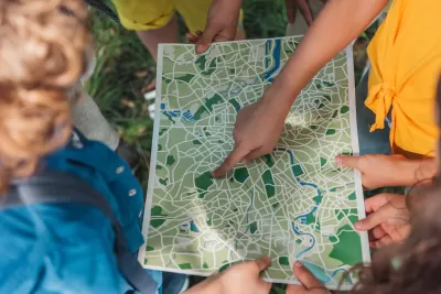
In today's urban environments, parks play a crucial role in enhancing physical, mental, and social well-being. As Este Geraghty shares in this article, the integration of Geographic Information Systems (GIS) into park planning and management has revolutionized how these green spaces are designed, ensuring they meet the diverse needs of communities. By analyzing data on park usage and mapping activity hotspots, GIS allows planners to optimize parks for physical activity, providing necessary facilities such as jogging paths and sports courts. This approach not only encourages more frequent and intense physical activity but also helps prevent chronic diseases like obesity and cardiovascular issues.
GIS technology is also instrumental in supporting mental health by improving access to parks and green spaces, which offer a respite from the stressors of urban life. By conducting gap analyses, planners can identify underserved communities and guide investments to improve park access, ensuring that all residents have the opportunity to benefit from these natural settings. Furthermore, GIS can help design therapeutic landscapes within parks that include elements like water features and greenery, which are proven to lower depression levels among individuals with regular park access.
Beyond individual health benefits, parks serve as vital communal spaces that foster social connectedness, a key component of overall well-being. GIS helps planners understand how parks are used for social interaction, allowing them to enhance these areas with amenities that encourage gatherings, such as picnic spots and playgrounds. Importantly, involving community members in the planning process through GIS visualization tools ensures that parks are designed to be inclusive and welcoming, thereby strengthening community bonds.
Lastly, the COVID-19 pandemic underscored the essential role of parks in public health, particularly as safe spaces for physical activity and social interaction when indoor facilities were closed. GIS has been invaluable in adapting park designs to meet public health guidelines, such as social distancing, and in mitigating climate change impacts by identifying areas at risk for extreme heat or flooding. By incorporating green infrastructure, parks can manage stormwater, reduce urban heat, and contribute to the resilience and sustainability of communities.
FULL STORY: Park Perspective Series: A Pathway to Healthier, Happier Communities with GIS


New Book Shows How Geographic Technology Tackles Global Challenges
In his new book, Jack Dangermond explores the transformative impact of GIS technology in solving global challenges through spatial data, highlighting its widespread application across sectors and its potential to design sustainable futures.

How the National Park Service Uses GIS
A new book demonstrates how the National Park Service uses GIS technology to meet its mission and showcases a selection of maps used for effectively managing national parks.

How GIS Helps Plan Parks
With constrained budgets, a geographic information system (GIS) may seem like a luxury for parks agencies. But to perform data-driven planning and advance park equity, GIS is an indispensable tool.

Planetizen Federal Action Tracker
A weekly monitor of how Trump’s orders and actions are impacting planners and planning in America.

Congressman Proposes Bill to Rename DC Metro “Trump Train”
The Make Autorail Great Again Act would withhold federal funding to the system until the Washington Metropolitan Area Transit Authority (WMATA), rebrands as the Washington Metropolitan Authority for Greater Access (WMAGA).

The Simple Legislative Tool Transforming Vacant Downtowns
In California, Michigan and Georgia, an easy win is bringing dollars — and delight — back to city centers.

The States Losing Rural Delivery Rooms at an Alarming Pace
In some states, as few as 9% of rural hospitals still deliver babies. As a result, rising pre-term births, no adequate pre-term care and harrowing close calls are a growing reality.

The Small South Asian Republic Going all in on EVs
Thanks to one simple policy change less than five years ago, 65% of new cars in this Himalayan country are now electric.

DC Backpedals on Bike Lane Protection, Swaps Barriers for Paint
Citing aesthetic concerns, the city is removing the concrete barriers and flexposts that once separated Arizona Avenue cyclists from motor vehicles.
Urban Design for Planners 1: Software Tools
This six-course series explores essential urban design concepts using open source software and equips planners with the tools they need to participate fully in the urban design process.
Planning for Universal Design
Learn the tools for implementing Universal Design in planning regulations.
Smith Gee Studio
City of Charlotte
City of Camden Redevelopment Agency
City of Astoria
Transportation Research & Education Center (TREC) at Portland State University
US High Speed Rail Association
City of Camden Redevelopment Agency
Municipality of Princeton (NJ)