


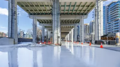
An update to the city’s zoning code makes way for a project that would reclaim a former highway and create new green space and recreation opportunities.
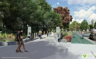
The city council in one of New York City’s densest suburbs approved new zoning rules that will allow a proposed linear park project to move forward.
According to a press release from the city of New Rochelle, a new DO-8 Overlay zoning district in the Lincoln neighborhood will “encourage new development, creation of a wider range of community-serving businesses and re-establish the neighborhood’s “community corners” at Lincoln Avenue and Brook Street.”
The project, dubbed LINC, “ will transform a portion of Memorial Highway into a walkable public linear park with over eight acres of lush green space, a new 14,000 square foot plaza with capacity for a 264-seat amphitheater, increased safety features, updated streetscapes and direct access to new economic opportunities for residents. Bike lanes will create direct access to the downtown Transit Center and connect neighborhoods west of Memorial Highway to the North Avenue shopping district and beyond.”
The historically Black neighborhood was negatively impacted by the construction of the highway, which destroyed homes and businesses in the area. The LINC project will also improve infrastructure such as stormwater and sewers to prevent flooding and improve permeability.
The city has received $45 million in funding for the project from sources including the U.S Department of Transportation’s FY23 Reconnecting Communities and Neighborhoods (RCN) and Neighborhood Access and Equity (NAE) grant programs, the U.S. DOT’s Rebuilding American Infrastructure with Sustainability and Equity (RAISE) program, and New York State’s Downtown Revitalization Initiative (DRI).
FULL STORY: New Rochelle City Council Adopts New Zoning to Advance LINC Project in Lincoln Avenue Neighborhood

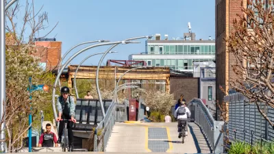
Montreal’s Gorilla Park Repurposes Defunct Railway Track
The park is part of a global movement to build public spaces that connect neighbors and work with local elements to serve as key parts of a city’s green infrastructure.
Don't Call it The 606: Chicago's Popular Linear Park Gets a New Name
The Chicago Park District wants to be extra sure we're all clear on this.

The Gentrification Effect of Urban Parks
New research finds that different types of parks correlate with different gentrification effects, adding to the complexity of urban change.

Planetizen Federal Action Tracker
A weekly monitor of how Trump’s orders and actions are impacting planners and planning in America.

San Francisco's School District Spent $105M To Build Affordable Housing for Teachers — And That's Just the Beginning
SFUSD joins a growing list of school districts using their land holdings to address housing affordability challenges faced by their own employees.

The Tiny, Adorable $7,000 Car Turning Japan Onto EVs
The single seat Mibot charges from a regular plug as quickly as an iPad, and is about half the price of an average EV.

Seattle's Plan for Adopting Driverless Cars
Equity, safety, accessibility and affordability are front of mind as the city prepares for robotaxis and other autonomous vehicles.

As Trump Phases Out FEMA, Is It Time to Flee the Floodplains?
With less federal funding available for disaster relief efforts, the need to relocate at-risk communities is more urgent than ever.

With Protected Lanes, 460% More People Commute by Bike
For those needing more ammo, more data proving what we already knew is here.
Urban Design for Planners 1: Software Tools
This six-course series explores essential urban design concepts using open source software and equips planners with the tools they need to participate fully in the urban design process.
Planning for Universal Design
Learn the tools for implementing Universal Design in planning regulations.
Smith Gee Studio
City of Charlotte
City of Camden Redevelopment Agency
City of Astoria
Transportation Research & Education Center (TREC) at Portland State University
US High Speed Rail Association
City of Camden Redevelopment Agency
Municipality of Princeton (NJ)