


The proposed Dorchester Greenway would create a new linear park above part of the Red Line subway.
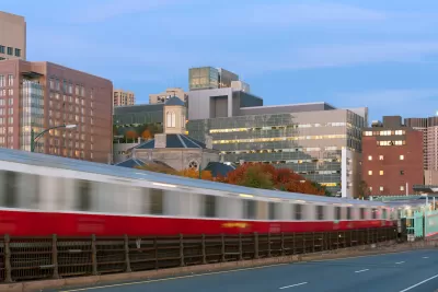
A proposed greenway would cap a 0.75-mile subterranean segment of Boston’s Red Line subway with a linear park, reports Daniel Roche in The Architect’s Newspaper. “With $300,000 in funding from the MassTrails program, a state initiative, and an additional $368,000 from the city of Boston; officials, community leaders, and designers are gearing up to build a new pathway for walkers and bikers, dubbed The Dorchester Greenway.”
According to Roche, “Today, the stretch between Fields Corner Station and Ashmont Station is below grade, topped by a derelict asphalt carpet. For years, community activists have sought to build a park on the land currently owned by the Massachusetts Bay Transportation Authority (MBTA).” Local advocates say the greenway would provide new public green space and stitch the neighborhood back together. Cap parks are becoming an increasingly popular way to utilize space above active or defunct freeways or subway lines, although some projects, like one in Denver, have triggered gentrification and displacement concerns.
FULL STORY: The Dorchester Greenway, a speculative linear park, may soon be built in Boston over the Red Line

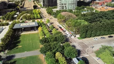
I Help Plan Cap Parks; Here’s What Austin Can Learn from Other Cities
How freeway capping projects can literally and metaphorically bridge urban divides.
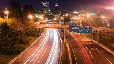
USDOT Denies Portland Freeway Expansion Grant
The agency declined the Oregon Department of Transportation’s request for $750 million to fund the I-5 Rose Quarter Improvement Project.
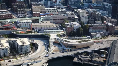
Seattle’s New Overlook Walk Offers Ample Park Space Near Pike Place Market
The elevated park and event space replaces part of the demolished Alaskan Way Viaduct, connecting the city’s famous Pike Place Market to the waterfront.

Planetizen Federal Action Tracker
A weekly monitor of how Trump’s orders and actions are impacting planners and planning in America.

San Francisco's School District Spent $105M To Build Affordable Housing for Teachers — And That's Just the Beginning
SFUSD joins a growing list of school districts using their land holdings to address housing affordability challenges faced by their own employees.

The Tiny, Adorable $7,000 Car Turning Japan Onto EVs
The single seat Mibot charges from a regular plug as quickly as an iPad, and is about half the price of an average EV.

Seattle's Plan for Adopting Driverless Cars
Equity, safety, accessibility and affordability are front of mind as the city prepares for robotaxis and other autonomous vehicles.

As Trump Phases Out FEMA, Is It Time to Flee the Floodplains?
With less federal funding available for disaster relief efforts, the need to relocate at-risk communities is more urgent than ever.

With Protected Lanes, 460% More People Commute by Bike
For those needing more ammo, more data proving what we already knew is here.
Urban Design for Planners 1: Software Tools
This six-course series explores essential urban design concepts using open source software and equips planners with the tools they need to participate fully in the urban design process.
Planning for Universal Design
Learn the tools for implementing Universal Design in planning regulations.
Smith Gee Studio
City of Charlotte
City of Camden Redevelopment Agency
City of Astoria
Transportation Research & Education Center (TREC) at Portland State University
US High Speed Rail Association
City of Camden Redevelopment Agency
Municipality of Princeton (NJ)