


Caltrans moved a segment of the state’s celebrated Highway 1 inland by 400 feet to avoid erosion caused by sea level rise.
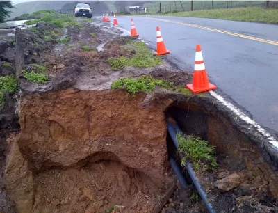
In a first for the California Department of Transportation (Caltrans), the agency moved a Sonoma County highway segment 400 feet inland to protect it from coastal erosion, reports Maggie Fusek in Patch Petaluma. The Gleason Beach Highway Realignment “involved building 4,000 feet of new highway, including an 810-foot, two-lane bridge with a separated pedestrian walkway and 12-foot shoulders to accommodate bicycle travel.”
According to State Sen. Mike McGuire, “This specific segment of Highway 1 has been especially challenging, constantly being undermined by coastal erosion near Scotty Creek.” The project removed a culvert, letting Scotty Creek flow “unimpeded to the ocean, allowing coho salmon and steelhead to swim upstream again to spawn,” and reconnected a wetland previously divided by the old road. “While the advancing ocean was the reason for this project, it would be foolish to imply that nature is our adversary,” said Caltrans Bay Area Director Dina El Tawansy.
FULL STORY: CA Highway 1 Moved 400 Feet, Marks 1st Sea-Level Rise Caltrans Project

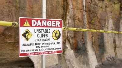
Atlantic Coast Infrastructure at Risk from Sea Level Rise
New research reveals that some coastal areas are sinking by as much as 5 millimeters per year, which could threaten key infrastructure.
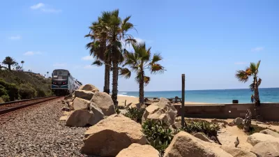
State Leaders Warn of Risks to Southern California Rail Corridor
Coastal erosion and rising sea levels threaten one of the nation’s most scenic—and strategically important—rail corridors.

California State Law Calls on Coastal Regions to Create Resiliency Plans
Cities and counties at risk of flooding and erosion from sea level rise can access state funding to implement coastal resiliency plans.

Montreal Mall to Become 6,000 Housing Units
Place Versailles will be transformed into a mixed-use complex over the next 25 years.

Planetizen Federal Action Tracker
A weekly monitor of how Trump’s orders and actions are impacting planners and planning in America.

DARTSpace Platform Streamlines Dallas TOD Application Process
The Dallas transit agency hopes a shorter permitting timeline will boost transit-oriented development around rail stations.

Without International Immigrants, the Rural US Population Would Be Falling 58%
Census data shows that population growth in rural areas is due in large part to international migrants.

Dead End: Nine Highways Ready for Retirement
The Freeways Without Futures report describes the nation’s most promising highway removal proposals.

Congressman Proposes Bill to Rename DC Metro “Trump Train”
The Make Autorail Great Again Act would withhold federal funding to the system until the Washington Metropolitan Area Transit Authority (WMATA), rebrands as the Washington Metropolitan Authority for Greater Access (WMAGA).
Urban Design for Planners 1: Software Tools
This six-course series explores essential urban design concepts using open source software and equips planners with the tools they need to participate fully in the urban design process.
Planning for Universal Design
Learn the tools for implementing Universal Design in planning regulations.
City of Mt Shasta
City of Camden Redevelopment Agency
City of Astoria
Transportation Research & Education Center (TREC) at Portland State University
City of Camden Redevelopment Agency
Municipality of Princeton (NJ)
Regional Transportation Commission of Southern Nevada