


Instead of removing urban freeways, which have proven to be destructive to communities and economies—in some cases deliberately so—many cities are expanding freeways in and around cities.
The New York Times recently published an interactive opinion piece that provides visual evidence of the mark left by freeways and highways on dense urban communities with maps and historic aerial photography superimposed with contemporary images.
The article was written by Adam Paul Susaneck, who might be more familiar to some readers as the founder of the Segregation by Design, a blog and Instagram account dedicated to documenting the destruction of transportation planning and housing and land use policy on communities of color in the United States.
“Through a series of stark aerial before-and-after comparisons, figure-ground diagrams, and demographic data, this project will reveal the extent to which the American city was methodically hollowed out based on race. The project will cover the roughly 180 municipalities which received federal funding from the 1956 Federal Highway Act, which created the interstate highway system,” according to the Blog’s about page.
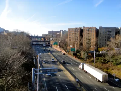
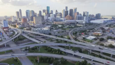
The New York Times article deploys that methodology in the article, first by focusing on the North Houston Highway Improvement Project, a project underway by the Texas Department of Transportation to widen Interstate 45 near downtown Houston, displacing an estimated 1,000 households and multiple other businesses and cultural resources in the process. Susaneck cites the project of an example of the same destructive planning practices of the 1960s at work in the 2020s.
“Rather than being a rare exception, projects like this one fit a longstanding pattern of how the United States chooses to force highways through communities with the least political power to resist. A Los Angeles Times analysis found that expansions of existing highways have displaced more than 200,000 people over the past three decades, predominantly in nonwhite neighborhoods,” writes Susaneck.
Other examples of car-centric planning and discriminatory housing practices gutting urban communities include the Cross Bronx Expressway, famously championed by Robert Moses, restrictive covenants in Minneapolis, and urban renewal in Chicago.
“The urban highway network and the urban renewal projects it spawned are tools of systemic discrimination. They’re also in terrible shape: The American Society of Civil Engineers gives the overall condition of America’s roads a D grade. As many of the highways built in the 1950s and ’60s reach the end of their useful life, now is the perfect opportunity to radically rethink the urban environment that shapes social relations within American city life,” writes Susaneck.
FULL STORY: Mr. Biden, Tear Down This Highway

The Limitations of ‘Reconnecting Communities’
The Biden administration has pledged to correct the damage imposed on communities by highways and infrastructure, but many projects are only committing to minor improvements, not transformative changes.
A Freeway Rebellion Rises in the Unlikeliest of States: Texas
“There’s no train, there’s no bus, there’s no anything that supports mass transportation. It doesn’t exist.” -Houston resident Fabian Ramirez.
15 of the 'Worst Highways in America'
The Congress for the New Urbanism's "Freeways Without Future 2021" report leverages the current political moment by spotlighting 15 U.S highways for removal.

Rethinking Redlining
For decades we have blamed 100-year-old maps for the patterns of spatial racial inequity that persist in American cities today. An esteemed researcher says: we’ve got it all wrong.

Montreal Mall to Become 6,000 Housing Units
Place Versailles will be transformed into a mixed-use complex over the next 25 years.

Planetizen Federal Action Tracker
A weekly monitor of how Trump’s orders and actions are impacting planners and planning in America.

Connecting Communities to Nature Close to Home
Los Angeles County’s Nature in Your Neighborhood program brings free, family-friendly wellness and nature activities to local parks, making it easier for residents to enjoy and connect with the outdoors.

Palmdale’s Beloved Water Park Gets $2 Million Upgrade
To mark its 20th anniversary, DryTown Water Park has undergone major renovations, ensuring that families across the Antelope Valley continue to enjoy safe, affordable, and much-needed water-based recreation in the high desert.

Help Stop the Beetle Killing Southern California’s Oak Trees
Claifornia residents can join a volunteer “blitz” this June to help detect and map infestations of an invasive beetle that is killing thousands of oak trees across Southern California.
Urban Design for Planners 1: Software Tools
This six-course series explores essential urban design concepts using open source software and equips planners with the tools they need to participate fully in the urban design process.
Planning for Universal Design
Learn the tools for implementing Universal Design in planning regulations.
City of Camden Redevelopment Agency
City of Astoria
Transportation Research & Education Center (TREC) at Portland State University
Regional Transportation Commission of Southern Nevada
Toledo-Lucas County Plan Commissions