


The Waymap app offers precise instructions to give blind pedestrians more options for safe travel.
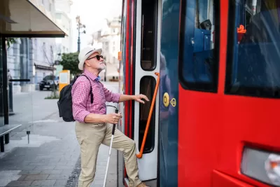
“An app designed to help visually impaired or blind pedestrians use public transit will debut at a Washington subway station on Tuesday,” reports David Shepardson for Reuters. “The app does not use GPS and can operate regardless of cellphone signal strength indoors or outdoors. It loads detailed mapping data onto a smartphone and uses motion sensors on the phone to offer precise directions.”
“Mobility is not a luxury,” said Waymap founder and CEO Tom Pey, who is blind and argues other apps are not precise enough. “It is, in fact, a human right.”
According to the article, “Waymap will be deployed in phases with the goal of deploying the app at up to 30 Metro train stations and nearly 1,000 bus stops by September and across the entire Metro system by early 2023.”
In the future, Pey says people without visual impairments could use the app “to help refine directions and improve the maps” for blind users.
FULL STORY: App to help blind people navigate public transit to debut in Washington

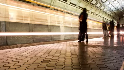
Mobile App Makes DC Transit Easy to Navigate for Visually Impaired Riders
The app gives step-by-step directions and audio and visual cues accessible from anywhere for thousands of bus stops and rail stations.

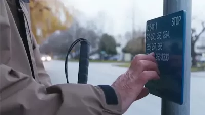
Making Trip Planning Easier for Vision-Impaired Transit Riders
The app provides navigation using audio and haptic cues to improve accessibility for people with low vision.
Braille Signage Now at All Vancouver Bus Stops
The city completed installation of signage for people with visual impairments at over 8,000 bus stops.

Planetizen Federal Action Tracker
A weekly monitor of how Trump’s orders and actions are impacting planners and planning in America.

DARTSpace Platform Streamlines Dallas TOD Application Process
The Dallas transit agency hopes a shorter permitting timeline will boost transit-oriented development around rail stations.

Congressman Proposes Bill to Rename DC Metro “Trump Train”
The Make Autorail Great Again Act would withhold federal funding to the system until the Washington Metropolitan Area Transit Authority (WMATA), rebrands as the Washington Metropolitan Authority for Greater Access (WMAGA).

Supreme Court Ruling in Pipeline Case Guts Federal Environmental Law
The decision limits the scope of a federal law that mandates extensive environmental impact reviews of energy, infrastructure, and transportation projects.

Texas State Bills to Defund Dallas Transit Die
DART would have seen a 30% service cut, $230M annual losses had the bills survived.

Bikeshare for the Win: Team Pedals to London Cricket Match, Beats Rivals Stuck in Traffic
While their opponents sat in gridlock, England's national cricket team hopped Lime bikes, riding to a 3-0 victory.
Urban Design for Planners 1: Software Tools
This six-course series explores essential urban design concepts using open source software and equips planners with the tools they need to participate fully in the urban design process.
Planning for Universal Design
Learn the tools for implementing Universal Design in planning regulations.
Roanoke Valley-Alleghany Regional Commission
City of Mt Shasta
City of Camden Redevelopment Agency
City of Astoria
Transportation Research & Education Center (TREC) at Portland State University
US High Speed Rail Association
City of Camden Redevelopment Agency
Municipality of Princeton (NJ)