


New research published by the Journal of Transport and Land Use analyzes tens of thousands of pedestrian fatalities over 16 years in the United States.
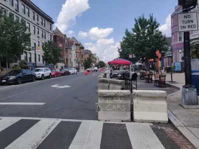
A study published by the Journal of Transport and Land Use provides an unprecedented map of traffic safety—or lack thereof—in the United States.
An article by Kea Wilson shares news of the new research: "In what may be the only attempt to map the U.S. corridors with the highest numbers of pedestrian deaths ever conducted, researchers analyzed data on every pedestrian crash fatality since the federal government began collecting standardized data on them in 2001, until 2016, the last year for which finalized data is available."
Three-quarters of the most fatal roads for pedestrians are located in low-income neighborhoods, according to one of the key findings of the research. There's a surprising amount of geographic variety to be found on the list of "hot spot" corridors—defined as 1,000-meter stretches of road where drivers have killed at least six pedestrians in eight years or less.
The surprisingly varied list spans communities from pedestrian-rich Northeastern megacities to car-dependent Sun Belt towns that routinely rank among the most dangerous for pedestrians. Notorious roads like U.S. Highway 19 in Pasco County, FL, made the list – the 20-mile corridor was the site of seven distinct hot spots and 137 walking fatalities during the study period, almost the same number of U.S. commercial airline deaths during the same years — but so did 12 corridors in New York City, which often ranks as the most walkable city in America.
The variety of the list does not extend to the designs of the roads, according to Wilson. "No matter the location, the design of the deadly roads were much the same: ultra-wide, blisteringly fast, and flanked by businesses to which residents walk every day."
As noted by Wilson, despite the growing rate of pedestrian fatalities in the United States, most cities don't map their worst crashes. Some advocates, like one cited in the source article, think cities should be required to map their pedestrian fatalities—and be required to undertake design and engineering improvements to reduce fatalities.
Rebecca L. Sanders, the founder and principal researcher of Safe Streets Research, LLC and a co-author of the study, is quoted in the article saying that the National Highway Traffic Safety Administration has the capability to get the geo-data on road characteristics near hot spots.
FULL STORY: The Most Dangerous Roads in America for Walkers


Debunking Traffic Safety Myths as Pedestrian Fatalities Increase
Angie Schmitt, former editor at Streetsblog USA, has written a new book about pedestrian fatalities, which works to dispel some of the myths about traffic safety in the United States.

Latest Traffic Safety Data Adds Grim Death Count to an Already Tragic Year
The public health epidemic created by dangerous roads, dangerous cars, and dangerous drivers was exacerbated by the COVID-19 pandemic, according to recent data from the National Highway Traffic Safety Administration.

Cleveland Ready for Vision Zero
Cleveland is working to become the latest U.S. city to set a goal to eliminate traffic fatalities.

Planetizen Federal Action Tracker
A weekly monitor of how Trump’s orders and actions are impacting planners and planning in America.

Maui's Vacation Rental Debate Turns Ugly
Verbal attacks, misinformation campaigns and fistfights plague a high-stakes debate to convert thousands of vacation rentals into long-term housing.

San Francisco Suspends Traffic Calming Amidst Record Deaths
Citing “a challenging fiscal landscape,” the city will cease the program on the heels of 42 traffic deaths, including 24 pedestrians.

Defunct Pittsburgh Power Plant to Become Residential Tower
A decommissioned steam heat plant will be redeveloped into almost 100 affordable housing units.

Trump Prompts Restructuring of Transportation Research Board in “Unprecedented Overreach”
The TRB has eliminated more than half of its committees including those focused on climate, equity, and cities.

Amtrak Rolls Out New Orleans to Alabama “Mardi Gras” Train
The new service will operate morning and evening departures between Mobile and New Orleans.
Urban Design for Planners 1: Software Tools
This six-course series explores essential urban design concepts using open source software and equips planners with the tools they need to participate fully in the urban design process.
Planning for Universal Design
Learn the tools for implementing Universal Design in planning regulations.
Heyer Gruel & Associates PA
JM Goldson LLC
Custer County Colorado
City of Camden Redevelopment Agency
City of Astoria
Transportation Research & Education Center (TREC) at Portland State University
Jefferson Parish Government
Camden Redevelopment Agency
City of Claremont