


New research assesses the land value of street space in 20 of the largest counties in the United States.
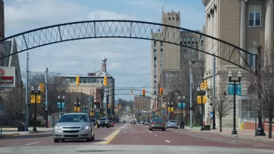
"During lockdowns, cities all over the world turned residential and commercial corridors into slow (or no) vehicle zones for pedestrians, cyclists, cafe seating, parklets and play," writes Laura Bliss in Bloomberg CityLab. Our ideas about what streets could be shifted radically in many places. Yet, before the pandemic, "people rarely questioned just how much space streets take up in the first place," says UCLA urban planning professor Adam Millard-Ball.
According to Millard-Ball's recent research into 20 U.S. counties, "streets took up 18% of the total land area in these counties, ranging from 14% in Middlesex County, Massachusetts (which contains the suburbs of Boston) to 30% in Kings County, New York (which is Brooklyn)." Millard-Ball also calculated the value of this space, "estimat[ing] that the residential streets in that area would be worth $959 billion if they were instead zoned for single-family homes, based on 2019 prices."
"Despite studies that show narrow streets are actually safer for users, large widths persist as required standards in local subdivision regulations." The programs created during the pandemic show that different uses are possible, and Millard-Ball argues the space could be better put to use as housing. "Cities could also allow owners to push property lines into streets to make way for front-yard ADUs or bigger, multi-family developments. And if that’s still too tricky, they could start by legalizing overnight parking for people who sleep in their cars and vans."
FULL STORY: MapLab: The High Cost of Wide Streets

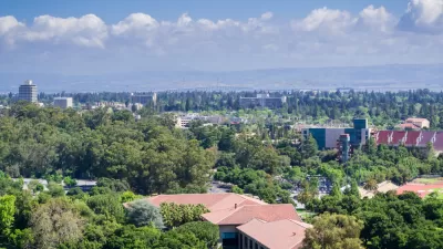
Opinion: Build Density in Palo Alto–and Lots of It
To keep up with demand and slow the astronomical rise in housing costs, Palo Alto and other Silicon Valley cities must overcome local opposition to density and high-rises.
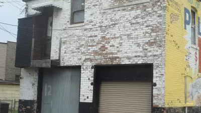
Chicago Coach Houses, Legalize 'Em
Coach houses could provide affordable housing and revenue for home owners if they were more widely permitted in the city.
The 'Missing Middle' Affordable Housing Solution
Karen Parolek discusses the 'Missing Middle' that is too often overlooked in discussions about affordable housing.

Planetizen Federal Action Tracker
A weekly monitor of how Trump’s orders and actions are impacting planners and planning in America.

San Francisco's School District Spent $105M To Build Affordable Housing for Teachers — And That's Just the Beginning
SFUSD joins a growing list of school districts using their land holdings to address housing affordability challenges faced by their own employees.

The Tiny, Adorable $7,000 Car Turning Japan Onto EVs
The single seat Mibot charges from a regular plug as quickly as an iPad, and is about half the price of an average EV.

With Protected Lanes, 460% More People Commute by Bike
For those needing more ammo, more data proving what we already knew is here.

In More Metros Than You’d Think, Suburbs are Now More Expensive Than the City
If you're moving to the burbs to save on square footage, data shows you should think again.

The States Losing Rural Delivery Rooms at an Alarming Pace
In some states, as few as 9% of rural hospitals still deliver babies. As a result, rising pre-term births, no adequate pre-term care and "harrowing" close calls are a growing reality.
Urban Design for Planners 1: Software Tools
This six-course series explores essential urban design concepts using open source software and equips planners with the tools they need to participate fully in the urban design process.
Planning for Universal Design
Learn the tools for implementing Universal Design in planning regulations.
Smith Gee Studio
City of Charlotte
City of Camden Redevelopment Agency
City of Astoria
Transportation Research & Education Center (TREC) at Portland State University
US High Speed Rail Association
City of Camden Redevelopment Agency
Municipality of Princeton (NJ)