


Louisiana's chemical plants could release tons of toxic pollution into the air and water during storms, but anti-terrorism provisions make the process of finding risk management information prohibitively difficult.
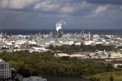
A new analysis by New Orleans Public Radio (WWNO) and Southerly reveals high levels of risk for Louisiana communities located near the state's coastal chemical plants. The facilities, located in the path of annual hurricanes, emit more air pollution when they shut down in preparation for storms. If damaged by high wind or flooding, the plants run the risk of catastrophic pollution events that can expose wide swaths of the local community to toxic chemicals. The study used EPA data to identify the 30 facilities in the state that store the most toxic materials on site and analyzed the worst-case scenario for each. In ten cases, toxic gases could travel as far as 25 miles from the incident.
Information regarding risk management isn't always easy to come by in the post-9/11 era, with the chemical industry citing the potential for terrorist attacks as a reason to keep their plans closely guarded. To view industry risk management plans, residents have to make an appointment, view plans in person, and only take hand-written notes in the presence of a U.S. Marshal. A spokesperson for Shell, which owns four of the thirty plants in the analysis, would not discuss details but wrote in an email to WWNO that safety is a "top priority," adding that their operations follow strict federal, state, and local regulations.
But the secrecy can have an impact on local communities who can't easily assess the risks to their residents and first responders who lack the information to prepare for emergency scenarios. Emma Cheuse, an attorney with Earthjustice, calls the lack of information a "ticking time bomb" for coastal towns. Earthjustice is suing the EPA for rolling back Obama-era regulatory improvements and pushing for increased transparency and access to risk management information that can protect communities and help them prepare for future disasters.
FULL STORY: 'Ticking Time Bombs': Residents Kept In The Dark About Risks To La.'s Chemical Plants During Storms

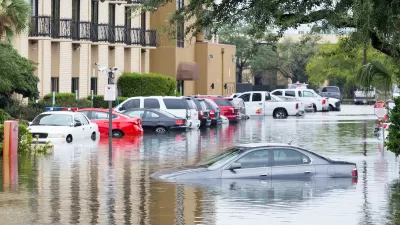
Migration to Disaster-Prone Areas Persists
Regions at high risk for flooding, wildfires, and other climate-fueled disasters continue to see rapid population growth.
‘Quality Work, Fast’: NC Gears up for Homebuilding After Helene, Trying to Avoid Past Pitfalls
The state will field bids to demolish, repair and rebuild homes in the mountains. After struggles in eastern NC, officials aim to chart a different course.

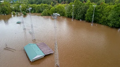
Rebuilding After Disaster: The Role of Social Connections in Resilience
Dr. Lucy Jones emphasizes that resilience in the face of climate-driven disasters like wildfires relies on building strong social connections, which empower communities to recover and adapt to an increasingly challenging future.

Montreal Mall to Become 6,000 Housing Units
Place Versailles will be transformed into a mixed-use complex over the next 25 years.

Planetizen Federal Action Tracker
A weekly monitor of how Trump’s orders and actions are impacting planners and planning in America.

DARTSpace Platform Streamlines Dallas TOD Application Process
The Dallas transit agency hopes a shorter permitting timeline will boost transit-oriented development around rail stations.

Interactive Map Reveals America's “Shade Deserts”
Launched by UCLA and American Forests to combat heat-related deaths, the tool maps the shade infrastructure for over 360 U.S. cities.

Bicycles and Books — In Sacramento, Libraries Now Offer Both
Adult library card holders can check out e-bikes and e-trikes for up to one week.

Colorado Landfills Emit as Much Pollution as 1M Cars
Landfills are the third-largest source of methane pollution in Colorado, after agriculture and fossil fuel extraction.
Urban Design for Planners 1: Software Tools
This six-course series explores essential urban design concepts using open source software and equips planners with the tools they need to participate fully in the urban design process.
Planning for Universal Design
Learn the tools for implementing Universal Design in planning regulations.
City of Mt Shasta
City of Camden Redevelopment Agency
City of Astoria
Transportation Research & Education Center (TREC) at Portland State University
City of Camden Redevelopment Agency
Municipality of Princeton (NJ)
Regional Transportation Commission of Southern Nevada