


A pair of reports analyzing U.S. Census Bureau poverty data from the last two decades show that high-poverty neighborhoods have become further impoverished.
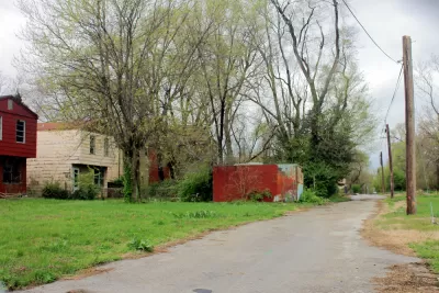
Two reports published by the Economic Innovation Group in May cover U.S. Census Bureau poverty data between 1980 and 2018. The reports found that since 1980, the number of neighborhoods below the poverty line has roughly doubled. Areas marked as low-income neighborhoods in the '80s became poorer by 2018, for the most part.
"Just as the number of poor metro neighborhoods has doubled, so has the number of people living in them — 24 million people were living in these high-poverty communities in 2018, according to the research," writes Marie Patino in coverage of the new reports. The research shows that most people living in poverty live in high-poverty areas.
Patino recounts that while these upsetting trends are clear, the authors spent little time in the report speaking to what can be done to reverse the trend. It remains the case that low-income areas tend to be more crowded, and their residents at even higher risk of contracting the coronavirus. "Those factors also make low-income areas in the U.S. an easy target for epidemics," says Patino.
FULL STORY: Poor Neighborhoods Are Only Getting Poorer

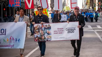
Another Delay for the Census: Now Expected for September Delivery
The pandemic and political mismanagement are continuing to have an effect on the 2020 Census.

Trump Decides to Cut the 2020 Census Short
The pandemic delayed the 2020 Census, and the Trump administration will cut it short. Experts say this could be the most flawed Census in the country's history.

100 Million 'New Poor' Predicted as a Result of the Pandemic
The fiscal effects of the pandemic are likely to make it very difficult for governments to invest in economic and quality of life improvements for people on the edge of poverty.

Planetizen Federal Action Tracker
A weekly monitor of how Trump’s orders and actions are impacting planners and planning in America.

Restaurant Patios Were a Pandemic Win — Why Were They so Hard to Keep?
Social distancing requirements and changes in travel patterns prompted cities to pilot new uses for street and sidewalk space. Then it got complicated.

Maui's Vacation Rental Debate Turns Ugly
Verbal attacks, misinformation campaigns and fistfights plague a high-stakes debate to convert thousands of vacation rentals into long-term housing.

In California Battle of Housing vs. Environment, Housing Just Won
A new state law significantly limits the power of CEQA, an environmental review law that served as a powerful tool for blocking new development.

Boulder Eliminates Parking Minimums Citywide
Officials estimate the cost of building a single underground parking space at up to $100,000.

Orange County, Florida Adopts Largest US “Sprawl Repair” Code
The ‘Orange Code’ seeks to rectify decades of sprawl-inducing, car-oriented development.
Urban Design for Planners 1: Software Tools
This six-course series explores essential urban design concepts using open source software and equips planners with the tools they need to participate fully in the urban design process.
Planning for Universal Design
Learn the tools for implementing Universal Design in planning regulations.
Heyer Gruel & Associates PA
JM Goldson LLC
Custer County Colorado
City of Camden Redevelopment Agency
City of Astoria
Transportation Research & Education Center (TREC) at Portland State University
Camden Redevelopment Agency
City of Claremont
Municipality of Princeton (NJ)