


An analysis of data about hospital capacity and possible infection trends shows that hospital facilities will be stretched thin even in the best-case scenario.
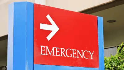
Teams from ProPublica and the Harvard Global Health Institute have analyzed and produced data visualizations on hospital capacity and readiness in communities across the country. The scenarios look at 20 percent, 40 percent, and 60 percent infection rates as well as spreading of the virus over periods of 6 months, 12 months, and 18 months.
"Even in a best-case scenario, with cases of coronavirus spread out over 18 months, American hospital beds would be about 95% full. (This assumes that hospitals don’t free up already occupied beds or add more beds, as some elected officials have called for.) Some regions would have the capacity to handle the surge in hospitalizations without adding new beds or displacing other patients," write Annie Waldman, Al Shaw, Ash Ngu, and Sean Campbell.
At the other end of the spectrum is the possibility of a high infection rate coupled with a shorter duration of spreading. "In the researchers’ worst-case scenario — if 60% of the population falls sick and the virus spreads within six months — the nation would require more than seven times the number of available hospital beds that it currently has," they report.
The article includes a feature that generates specific figures on hospital beds available, the projected number of coronavirus patients, and the number of additional hospital beds that will be needed for a particular city or region. The authors also take a closer look at the situations in different areas, urban and rural, and the challenges hospital facilities will face as the pandemic continues.
FULL STORY: Are Hospitals Near Me Ready for Coronavirus? Here Are Nine Different Scenarios.


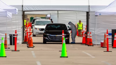
California's Hospital Crisis: What Lies Ahead
As COVID infections and hospitalizations mount in California, ICU availability dropped to zero in Southern and Central California. Demand for hospital care is also outstripping supply in New Mexico.

The Two Conflicting Sides of the Federal Approach to the Pandemic
While President Trump is publicly stating the virus "will soon disappear," his task force is releasing detailed, county-level data on how all 50 states are dealing with the coronavirus and making recommendations – but the reports are not public.
A Grim Coronavirus Milestone: 150,000 American Deaths
A grim warning was issued by the non-profit group that represents America's medical schools and teaching hospitals: if the nation doesn't change its response to the pandemic, "Multiples of hundreds of thousands" of additional deaths may occur.

Planetizen Federal Action Tracker
A weekly monitor of how Trump’s orders and actions are impacting planners and planning in America.

Congressman Proposes Bill to Rename DC Metro “Trump Train”
The Make Autorail Great Again Act would withhold federal funding to the system until the Washington Metropolitan Area Transit Authority (WMATA), rebrands as the Washington Metropolitan Authority for Greater Access (WMAGA).

DARTSpace Platform Streamlines Dallas TOD Application Process
The Dallas transit agency hopes a shorter permitting timeline will boost transit-oriented development around rail stations.

San Francisco's School District Spent $105M To Build Affordable Housing for Teachers — And That's Just the Beginning
SFUSD joins a growing list of school districts using their land holdings to address housing affordability challenges faced by their own employees.

Car-Centric LA Suburb Looks to a Train-Oriented Future
City leaders in Rancho Cucamonga, the future western terminus of the Brightline West rail line to Las Vegas, want to reimagine the city as a transit-oriented, pedestrian-friendly community.

New Alaska Bitcoin Mine Would Burn as Much Energy as the State’s Largest Coal Plant
Fueled by “stranded” natural gas, the startup hopes to become the largest in the US, and to make Alaska an industry center.
Urban Design for Planners 1: Software Tools
This six-course series explores essential urban design concepts using open source software and equips planners with the tools they need to participate fully in the urban design process.
Planning for Universal Design
Learn the tools for implementing Universal Design in planning regulations.
Municipality of Princeton
Roanoke Valley-Alleghany Regional Commission
City of Mt Shasta
City of Camden Redevelopment Agency
City of Astoria
Transportation Research & Education Center (TREC) at Portland State University
US High Speed Rail Association
City of Camden Redevelopment Agency
Municipality of Princeton (NJ)