


Navigation app Waze has long allowed users the ability to report various "inconveniences" on the road, like speed traps, checkpoints, and crashes. Now Google Maps users on iPhone can do the same.
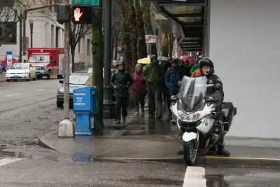
A new feature for Google Maps on the iPhone will inform users of the locations of speed traps and checkpoints, according to an article by Marie C. Baca, who wastes no time in speculating about the new tool is likely to be used by drivers.
"IPhone users who want to avoid the police can now hit up Google Maps before they hit the gas."
"Google is rolling out the ability to report speed traps, crashes and slowdowns in real time to its Maps iOS app, making the new feature available to about 1 billion existing users worldwide," adds Baca. The feature was "already available on Android phones, as well as on Google’s other map app, Waze, which has a fraction of the users."
Law enforcement agencies in the United States have historically not been supportive of the reporting feature, according to Baca, saying it heightens safety risks on the road.
FULL STORY: Google Maps now shows speed traps, potentially raising the ire of law enforcement

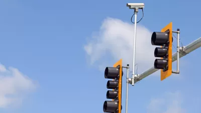
Study Assesses Attitudes on Traffic Cameras in Boston’s Black Communities
Residents are wary of the new technology’s potential for surveillance, but support boosting enforcement while reducing interaction with police.
Vision Zero...Without the Enforcement
As a leading bicycle advocacy organization withdraws support for police enforcement of Vision Zero plans, the discretionary practices of traffic enforcement come under rejuvenated scrutiny.

Lack of Traffic Safety Enforcement Blamed for Vision Zero Failures
Education, engineering, and enforcement are the three "e's" of Vision Zero in San Francisco. A lack of on of those "e's"—enforcement—might explain why more people are dying on the city's streets this year that any year since the city adopted Vision Z

Planetizen Federal Action Tracker
A weekly monitor of how Trump’s orders and actions are impacting planners and planning in America.

Congressman Proposes Bill to Rename DC Metro “Trump Train”
The Make Autorail Great Again Act would withhold federal funding to the system until the Washington Metropolitan Area Transit Authority (WMATA), rebrands as the Washington Metropolitan Authority for Greater Access (WMAGA).

The Simple Legislative Tool Transforming Vacant Downtowns
In California, Michigan and Georgia, an easy win is bringing dollars — and delight — back to city centers.

The States Losing Rural Delivery Rooms at an Alarming Pace
In some states, as few as 9% of rural hospitals still deliver babies. As a result, rising pre-term births, no adequate pre-term care and harrowing close calls are a growing reality.

The Small South Asian Republic Going all in on EVs
Thanks to one simple policy change less than five years ago, 65% of new cars in this Himalayan country are now electric.

DC Backpedals on Bike Lane Protection, Swaps Barriers for Paint
Citing aesthetic concerns, the city is removing the concrete barriers and flexposts that once separated Arizona Avenue cyclists from motor vehicles.
Urban Design for Planners 1: Software Tools
This six-course series explores essential urban design concepts using open source software and equips planners with the tools they need to participate fully in the urban design process.
Planning for Universal Design
Learn the tools for implementing Universal Design in planning regulations.
Smith Gee Studio
City of Charlotte
City of Camden Redevelopment Agency
City of Astoria
Transportation Research & Education Center (TREC) at Portland State University
US High Speed Rail Association
City of Camden Redevelopment Agency
Municipality of Princeton (NJ)