


The Los Angeles City Council voted to officially end the use of Level of Service in measuring environmental impact in favor of a more people-friendly measure: vehicle miles traveled.

Joe Linton reports from Lo Angeles, where the City Council recently approved a substantial change to environmental review in accordance with the California Environmental Quality Act (CEQA).
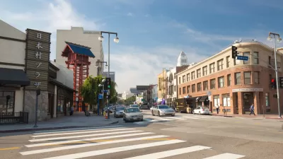
Linton describes the consequences of choosing LOS as the primary measure of a development project's impact:
LOS is a way of measuring traffic, though it perniciously and simplistically only measures car traffic, and doesn’t even do that meaningfully. Measuring for LOS shows any project that increases car congestion – such as building new housing – as adversely impacting the environment. To supposedly fix congestion – the adverse environmental impact of that new housing – LOS measurements end up requiring more space for cars, so a housing project might also have to widen the road. LOS incorrectly assumes that car traffic is a static quantity, denying the effects of induced travel. LOS said that the 405 Freeway would be less congested after it was widened. That didn’t happen.
The change from LOS to VMT was mandated by SB 743, a law approved by the state of California in 2013. Several cities in the state have already made the switch, including Pasadena and San Francisco. Outside of the state, Seattle is also working on reforming its use of Level of Service as a measure of development impact mitigation.
For more details on the effort by the city of Los Angeles to replace LOS analysis with VMT, see also a post by Steven Sharp from February 2019.
FULL STORY: Big Wonky Good News: L.A. City Adopts People-Centered Transportation Metric: “VMT” In, “LOS” Out


New Rule on Environmental Impacts of Driving, Long Awaited, Goes Into Effect Today
At long last, California law will consider the amount of driving, rather than vehicle delay, when evaluating the environmental impacts of new developments. This is a more common-sense approximation of their environmental impacts.
The Final Days of 'Level of Service' in California's Environmental Review Process
A long-awaited draft update of the California Environmental Quality Act (CEQA) has finally been released, and Level of Service will finally be a thing of the past in the next two to four years.
California Environmental Law Continues to Frustrate Bike Planning (for Now)
Help is on the way. The law that requires the governor's planning office to devise an alternative method for measuring vehicle traffic for environmental compliance will also take up where an earlier law that exempted bike lanes from CEQA left off.

Rethinking Redlining
For decades we have blamed 100-year-old maps for the patterns of spatial racial inequity that persist in American cities today. An esteemed researcher says: we’ve got it all wrong.

Montreal Mall to Become 6,000 Housing Units
Place Versailles will be transformed into a mixed-use complex over the next 25 years.

Planetizen Federal Action Tracker
A weekly monitor of how Trump’s orders and actions are impacting planners and planning in America.

Connecting Communities to Nature Close to Home
Los Angeles County’s Nature in Your Neighborhood program brings free, family-friendly wellness and nature activities to local parks, making it easier for residents to enjoy and connect with the outdoors.

Palmdale’s Beloved Water Park Gets $2 Million Upgrade
To mark its 20th anniversary, DryTown Water Park has undergone major renovations, ensuring that families across the Antelope Valley continue to enjoy safe, affordable, and much-needed water-based recreation in the high desert.

Help Stop the Beetle Killing Southern California’s Oak Trees
Claifornia residents can join a volunteer “blitz” this June to help detect and map infestations of an invasive beetle that is killing thousands of oak trees across Southern California.
Urban Design for Planners 1: Software Tools
This six-course series explores essential urban design concepts using open source software and equips planners with the tools they need to participate fully in the urban design process.
Planning for Universal Design
Learn the tools for implementing Universal Design in planning regulations.
Heyer Gruel & Associates PA
City of Clovis
City of Camden Redevelopment Agency
City of Astoria
Transportation Research & Education Center (TREC) at Portland State University
Regional Transportation Commission of Southern Nevada
Toledo-Lucas County Plan Commissions