


The use of level of service (LOS) to gauge the success of roadway networks has shaped and influenced cities in many negative ways.
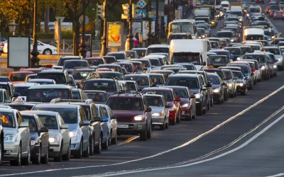
Lara Fishbane, Joseph Kane, and Adie Tomer of Brookings take a closer look at the level of service measure and the problems its use causes. LOS essentially measures congestion, but it also guides transportation planning as decision makers, planners, and other stakeholders work to improve LOS scores.
When LOS is used in efforts to address congestion, the solution too often is to build more roads, say Fishbane, Kane, and Tomer. The results are sprawl and transportation networks that decimate communities and privilege cars over other modes. "In short, the auto-centric development LOS makes possible has become one of the greatest obstacles to transportation choice and access, economic agglomeration, and environmental resilience."
They argue that different measures are needed — for example, multimodal measures and those that consider vehicle miles traveled instead of LOS. "Decreasing reliance on LOS also means introducing measures that don’t lead with transportation use, but instead with measures related to economic, social, and environmental outcomes," point out Fishbane, Kane, and Tomer.
In addition, they urge a shift away from a supply focus, which supports LOS, to one on travel demand. The result, they say, will be a better understanding of why people travel, how transportation systems can better serve users, and ways travel behavior can be changed.
FULL STORY: Stop trying to solve traffic and start building great places

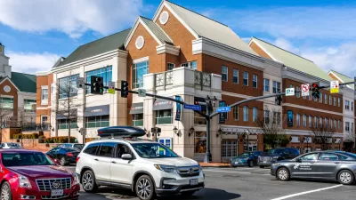
Shifting the Focus for Transportation Planning in Fairfax County
Fairfax County wants to move away from a heavy reliance on level of service in favor of more pedestrian- and transit-oriented planning.
Caltrans to Ditch Level of Service for Vehicle Miles Traveled
Unlike for land use regulations, state law doesn't require Caltrans to switch from Level of Service to Vehicle Miles Traveled in measuring the environmental impact of projects. The state department of transportation is making the change anyway.

Kids Still Aren't Walking to School
Two generations ago, most children walked to school. But the numbers have dropped significantly.

Maui's Vacation Rental Debate Turns Ugly
Verbal attacks, misinformation campaigns and fistfights plague a high-stakes debate to convert thousands of vacation rentals into long-term housing.

Planetizen Federal Action Tracker
A weekly monitor of how Trump’s orders and actions are impacting planners and planning in America.

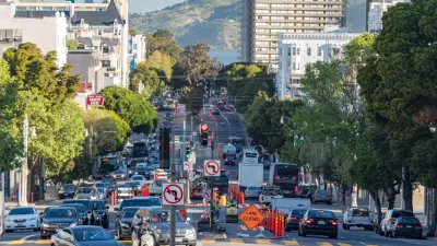
San Francisco Suspends Traffic Calming Amidst Record Deaths
Citing “a challenging fiscal landscape,” the city will cease the program on the heels of 42 traffic deaths, including 24 pedestrians.

Defunct Pittsburgh Power Plant to Become Residential Tower
A decommissioned steam heat plant will be redeveloped into almost 100 affordable housing units.

Trump Prompts Restructuring of Transportation Research Board in “Unprecedented Overreach”
The TRB has eliminated more than half of its committees including those focused on climate, equity, and cities.

Amtrak Rolls Out New Orleans to Alabama “Mardi Gras” Train
The new service will operate morning and evening departures between Mobile and New Orleans.
Urban Design for Planners 1: Software Tools
This six-course series explores essential urban design concepts using open source software and equips planners with the tools they need to participate fully in the urban design process.
Planning for Universal Design
Learn the tools for implementing Universal Design in planning regulations.
Heyer Gruel & Associates PA
JM Goldson LLC
Custer County Colorado
City of Camden Redevelopment Agency
City of Astoria
Transportation Research & Education Center (TREC) at Portland State University
Jefferson Parish Government
Camden Redevelopment Agency
City of Claremont