


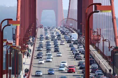
The city is seeing more transit use and biking, but driving and congestion are also on the rise.
The San Francisco Municipal Transportation Agency recently released its latest assessment of transportation trends in the city, the San Francisco Mobility Trends Report 2018. "Compiled by SFMTA staff, the report assesses which methods of transit SF residents are most likely to use, employing everything from traffic counts to official ridership stats from transit agencies to Census data about bike use," reports Adam Brinklow.
While the report says that transit use and cycling has increased since 2010, particular time frames tell different stories. For example, transit ridership is still down from a peak in 2002, and biking has decreased in recent years, with a more than 24 percent drop since 2015.
In addition, the growth in San Francisco's population has resulted in a 6 percent increase in registered vehicles since 2010 as well as more congestion. The report says that half of the congestion from 2010 to 2016 can be attributed to ride hailing and the other half to population and employment changes.
The increase in transit use in San Francisco distinguishes it from most other U.S. cities where transit ridership is in decline. "However, it’s still clear from the analysis that City Hall has trouble breaking San Franciscans from their reliance on cars. Silicon Valley is only exacerbating the situation," notes Brinklow.
FULL STORY: Despite everything, San Franciscans are driving more

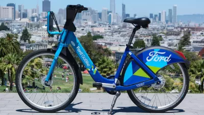
A Bikeshare Showdown Between Uber and Lyft
Lyft may soon not be the sole bikeshare operation in San Francisco as the city looks to expand the system and open the market up to other companies.

Bus-Only Lanes in San Francisco Show Impressive Results
Bus lanes along a primary transit corridor have sped up travel times and point to the potential for major citywide improvements.

In Cities, Transit Isn’t Just for Commuting
A closer look at commuting and ridership shows the differences between urban and suburban transit patterns.

Montreal Mall to Become 6,000 Housing Units
Place Versailles will be transformed into a mixed-use complex over the next 25 years.

Planetizen Federal Action Tracker
A weekly monitor of how Trump’s orders and actions are impacting planners and planning in America.

DARTSpace Platform Streamlines Dallas TOD Application Process
The Dallas transit agency hopes a shorter permitting timeline will boost transit-oriented development around rail stations.

Interactive Map Reveals America's “Shade Deserts”
Launched by UCLA and American Forests to combat heat-related deaths, the tool maps the shade infrastructure for over 360 U.S. cities.

Bicycles and Books — In Sacramento, Libraries Now Offer Both
Adult library card holders can check out e-bikes and e-trikes for up to one week.

Colorado Landfills Emit as Much Pollution as 1M Cars
Landfills are the third-largest source of methane pollution in Colorado, after agriculture and fossil fuel extraction.
Urban Design for Planners 1: Software Tools
This six-course series explores essential urban design concepts using open source software and equips planners with the tools they need to participate fully in the urban design process.
Planning for Universal Design
Learn the tools for implementing Universal Design in planning regulations.
City of Mt Shasta
City of Camden Redevelopment Agency
City of Astoria
Transportation Research & Education Center (TREC) at Portland State University
City of Camden Redevelopment Agency
Municipality of Princeton (NJ)
Regional Transportation Commission of Southern Nevada