


A closer look at commuting and ridership shows the differences between urban and suburban transit patterns.

Alon Levy of the Pedestrian Observations blog compares commuter ridership on urban transit and commuter rail. He finds that in San Francisco the total number of riders on four parallel east-west Muni bus routes serving the central business district is almost twice the maximum number of commuters:
This represents an implausible 184% mode share, in a part of the city where a good number of people own and drive cars, and where some in the innermost areas could walk to work. What’s happening is that when the transit system is usable, people take it for more than just their commute trips.
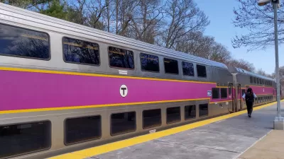
He then looks at the Massachusetts Bay Transportation Authority’s regional rail and riders coming into Boston’s CBD from suburbs and city neighborhoods near rail. Levy finds the mode share to be just 32 percent, and he notes that most commuters use other modes and very few commuter rail passengers are using rail for other non-work trips.
The difference between San Francisco and Boston is partly due to the geographic distribution of the non-work places people need to reach for shopping, errands, and services. In a city, travelers can use transit to reach these locales, but they are more likely in the suburbs to drive to them.
Levy also says that regions with transit systems that cater to commuters — trains arriving once an hour during off-peak hours, for example — will not be able to attract other types of riders. "If the station placement is designed around car travel, as is the case for all American commuter lines and some suburban rapid transit (including the tails of BART), then people will just drive all the way unless there’s peak congestion. Only very good urban transit can get this non-work ridership," he says.
FULL STORY: Urban Transit Vs. Commuter Transit


MBTA to Electrify its First Commuter Rail Line
The Massachusetts Bay Transportation Authority will electrify the 9 mile Fairmount Line, the shortest of their 12 commuter rail lines, using battery-electric multiple units. The first BEMU trains are projected to be operating in early 2028.
Boston Transit Ridership Grows Steadily
Ridership on the region’s commuter rail reached 80 percent of pre-pandemic levels in March.
Transit Plans Change as the Pandemic Lingers
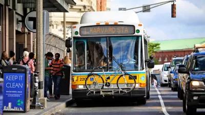
The Massachusetts Bay Transportation Authority (MBTA) this week proposed cuts to public transit service. In a decision that will likely repeat as more transit agencies undertake similar processes, the MBTA decided to prioritize buses over trains.

Planetizen Federal Action Tracker
A weekly monitor of how Trump’s orders and actions are impacting planners and planning in America.

Maui's Vacation Rental Debate Turns Ugly
Verbal attacks, misinformation campaigns and fistfights plague a high-stakes debate to convert thousands of vacation rentals into long-term housing.

San Francisco Suspends Traffic Calming Amidst Record Deaths
Citing “a challenging fiscal landscape,” the city will cease the program on the heels of 42 traffic deaths, including 24 pedestrians.

Defunct Pittsburgh Power Plant to Become Residential Tower
A decommissioned steam heat plant will be redeveloped into almost 100 affordable housing units.

Trump Prompts Restructuring of Transportation Research Board in “Unprecedented Overreach”
The TRB has eliminated more than half of its committees including those focused on climate, equity, and cities.

Amtrak Rolls Out New Orleans to Alabama “Mardi Gras” Train
The new service will operate morning and evening departures between Mobile and New Orleans.
Urban Design for Planners 1: Software Tools
This six-course series explores essential urban design concepts using open source software and equips planners with the tools they need to participate fully in the urban design process.
Planning for Universal Design
Learn the tools for implementing Universal Design in planning regulations.
Heyer Gruel & Associates PA
JM Goldson LLC
Custer County Colorado
City of Camden Redevelopment Agency
City of Astoria
Transportation Research & Education Center (TREC) at Portland State University
Jefferson Parish Government
Camden Redevelopment Agency
City of Claremont