


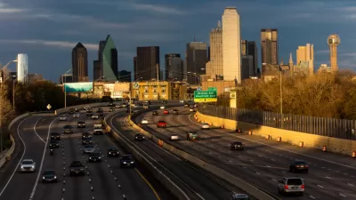
A plan to widen the Interstate 30 in Dallas is pitting state transportation officials, with ostensible goals to serve regional transportation needs, against local officials, who are more concerned with "neighborhood-centric ideals."
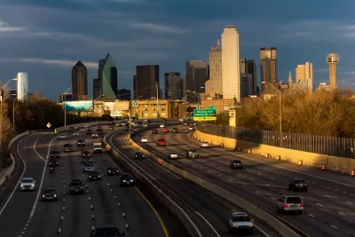
Robert Wilonsky reports on the local resistance to a state plan to widen Interstate 30 in the heart of Dallas. The resistance is coming from City Hall.
"The Texas Department of Transportation last May sent Dallas City Hall a sneak peek at its plans to redo Interstate 30 East, from downtown past Fair Park to Haskell Avenue," writes Wilonsky, who goes on to describe the reaction of local officials.
Shocked because the state's transportation agency proposed to make the highway wider, with more lanes, exit ramps and frontage roads. Shocked because the design created more barriers between downtown and East Dallas, the Cedars, Fair Park and Deep Ellum, and gobbled up enormous swaths of real estate that could be used for development instead of more concrete. And shocked because TxDOT had proposed something that went against its very own CityMAP, the design document City Hall wholeheartedly embraced in the summer of 2016.
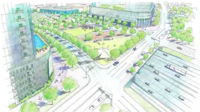
The Dallas Transportation Department has been working on a rebuttal, presenting the document [pdf] to the City Council's Mobility Solutions, Infrastructure, and Sustainability Committee this week. Local officials are hoping for the renovation of I-30 to reconnect South Dallas and Downtown while helping to revitalize Fair Park. The Dallas Transportation Department thus has proposed eight guiding principles it hopes the state will use to guide future refinements of the highway plan.
FULL STORY: Dallas City Hall beats back TxDOT's early plans for I-30's $1.3 billion makeover

TxDOT Promises to Reverse Some of the Damage Caused by Urban Freeways in Dallas
The Texas Department of Transportation (TxDOT) is in the early stages of planning for two projects that could leverage plans to rebuild two freeways in the city with plan to reconnect the neighborhoods they severed.
Highway Expansion Could Be Calamitous for Dallas' City Center
After a 2016 Texas Department of Transportation plan put forward a vision for a more walkable and dense city, TxDOT is still looking to expand I-30, a project that contradicts many of the forward-thinking ideas in that plan.
Major Battle Over Highway Project Funding Looms in North Texas
To ensure funding for the LBJ East, Texas Transportation Commission officials might take three other major highway projects off the table.

Planetizen Federal Action Tracker
A weekly monitor of how Trump’s orders and actions are impacting planners and planning in America.

Maui's Vacation Rental Debate Turns Ugly
Verbal attacks, misinformation campaigns and fistfights plague a high-stakes debate to convert thousands of vacation rentals into long-term housing.

Cuomo Is the Candidate of Both NIMBYs and Developers. What Gives?
In the New York City mayoral race, odd bedfellows align to preserve the housing status quo.

Amtrak Rolls Out New Orleans to Alabama “Mardi Gras” Train
The new service will operate morning and evening departures between Mobile and New Orleans.

The Subversive Car-Free Guide to Trump's Great American Road Trip
Car-free ways to access Chicagoland’s best tourist attractions.

San Antonio and Austin are Fusing Into one Massive Megaregion
The region spanning the two central Texas cities is growing fast, posing challenges for local infrastructure and water supplies.
Urban Design for Planners 1: Software Tools
This six-course series explores essential urban design concepts using open source software and equips planners with the tools they need to participate fully in the urban design process.
Planning for Universal Design
Learn the tools for implementing Universal Design in planning regulations.
Heyer Gruel & Associates PA
JM Goldson LLC
Custer County Colorado
City of Camden Redevelopment Agency
City of Astoria
Transportation Research & Education Center (TREC) at Portland State University
Jefferson Parish Government
Camden Redevelopment Agency
City of Claremont