


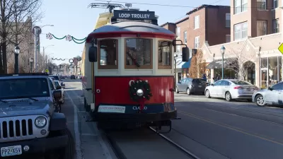
First, a snow day delayed the opening of the Loop Trolley in St. Louis. Then, the trolley didn't runt the full route. Finally, the trolley line became a crime scene.

"The Loop Trolley got off to a slow start Friday afternoon," reports Mark Schlinkmann.
First, the trolley's originally planned opening, scheduled for Thursday, had to be postponed due to snow.
Then, "[t]he trolley system's two cars only traveled along part of the route in St. Louis, between the Missouri History Museum in Forest Park and a stop at the corner of Delmar Boulevard and Des Peres Avenue." According to Schlinkmann, service was limited due to "glitch" with the conditional use permit issued by University City.
That was a prelude, however, to gunfire near the trolley after a car crash. "Crime scene tape blocked the trolley route as officers investigated the shooting," according to Schlinkmann.
The article includes more details about why University City isn't ready to let the trolley roll over its entire route. Apparently, "there are nine issues that the trolley operators have known about for a year or more that still must be addressed."
FULL STORY: Loop Trolley's first day: A 'bureaucratic snafu' kept it from running full route. Then, crime scene tape.

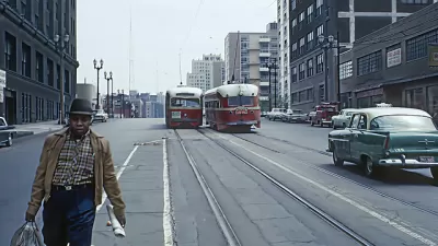
Loop Trolley on the Ropes in St. Louis
Extremely poor ridership might be dooming the St. Louis Loop Trolley less than a year after it opened to the public.
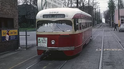
St. Louis Trolley Plans Hit a Snag
The St. Louis trolley revival is running out of cash.
St. Louis Trolley Hoping to Increase Hours
The St. Louis Trolley should begin operating later this year, but planners are hoping for additional funding to allow the service to operate longer hours.

Planetizen Federal Action Tracker
A weekly monitor of how Trump’s orders and actions are impacting planners and planning in America.

Congressman Proposes Bill to Rename DC Metro “Trump Train”
The Make Autorail Great Again Act would withhold federal funding to the system until the Washington Metropolitan Area Transit Authority (WMATA), rebrands as the Washington Metropolitan Authority for Greater Access (WMAGA).

The Simple Legislative Tool Transforming Vacant Downtowns
In California, Michigan and Georgia, an easy win is bringing dollars — and delight — back to city centers.

Supporting Cycling Takes More Than Just Bike Lanes
Safe, protected bike lanes are a key part of a city’s bike infrastructure — but secure parking, e-bike charging, and other amenities can also influence people’s shift to cycling.

Judge Blocks Anti-DEI Rules for Transportation, Housing Grants
A second injunction blocks the Trump administration from enforcing new regulations for federal funding.

Unhoused People in San Jose Could Face Arrest if They Refuse Shelter
A policy proposed by the city’s mayor would give law enforcement the option to arrest homeless residents if they refuse three offers of housing.
Urban Design for Planners 1: Software Tools
This six-course series explores essential urban design concepts using open source software and equips planners with the tools they need to participate fully in the urban design process.
Planning for Universal Design
Learn the tools for implementing Universal Design in planning regulations.
Smith Gee Studio
City of Charlotte
City of Camden Redevelopment Agency
City of Astoria
Transportation Research & Education Center (TREC) at Portland State University
US High Speed Rail Association
City of Camden Redevelopment Agency
Municipality of Princeton (NJ)