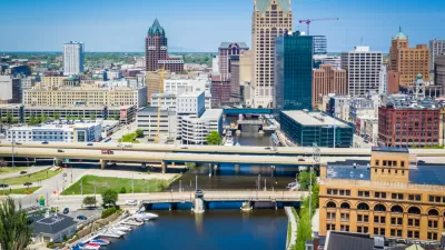
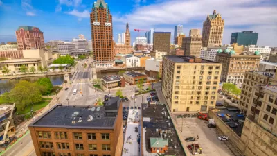
Charlotte's North Tryon Vision Plan is "among the more ambitious long-term urban planning projects in American cities," this article. Released in 2015, the plan's work is not done.

The North Tryon Vision Plan is moving the city of Charlotte creating a new model for planning in the downtown core compared to the car-centric mode of the 20th century planning.
"In a part of town that houses old churches, the main branch of the library and the NFL and NBA stadiums — plus all the surface parking lots that come with that — the city has designated a 60-acre, 50-square block area as a place for modern, urban redesign, dubbed the North Tryon Vision Plan," according to Daniel J. McGraw.
"The plan prioritizes walkable areas, a shrunken complete-streets grid, limited underground parking, play parks, and other small gathering places built for people and not their cars."
According to McGraw's take on the North Tryon Vision Plan, the city of Charlotte is working to do accomplish less than the reversal of historic trends that moved bedroom communities and office parks to the periphery, while leaving only office buildings, devoid of live in the evenings, in the central city. According to an Urban Land Institute study completed in November 2016 [pdf], Charlotte is the 50th most walkable city in the United States.
As noted by McGraw, the plan was released in 2015, but is still playing out for specific developments, such as the Hal Marshall Center and Spirit Square.
FULL STORY: Charlotte Moves toward a Car-Free City Center

Planetizen Federal Action Tracker
A weekly monitor of how Trump’s orders and actions are impacting planners and planning in America.

Maui's Vacation Rental Debate Turns Ugly
Verbal attacks, misinformation campaigns and fistfights plague a high-stakes debate to convert thousands of vacation rentals into long-term housing.

Restaurant Patios Were a Pandemic Win — Why Were They so Hard to Keep?
Social distancing requirements and changes in travel patterns prompted cities to pilot new uses for street and sidewalk space. Then it got complicated.

In California Battle of Housing vs. Environment, Housing Just Won
A new state law significantly limits the power of CEQA, an environmental review law that served as a powerful tool for blocking new development.

Boulder Eliminates Parking Minimums Citywide
Officials estimate the cost of building a single underground parking space at up to $100,000.

Orange County, Florida Adopts Largest US “Sprawl Repair” Code
The ‘Orange Code’ seeks to rectify decades of sprawl-inducing, car-oriented development.
Urban Design for Planners 1: Software Tools
This six-course series explores essential urban design concepts using open source software and equips planners with the tools they need to participate fully in the urban design process.
Planning for Universal Design
Learn the tools for implementing Universal Design in planning regulations.
Heyer Gruel & Associates PA
JM Goldson LLC
Custer County Colorado
City of Camden Redevelopment Agency
City of Astoria
Transportation Research & Education Center (TREC) at Portland State University
Jefferson Parish Government
Camden Redevelopment Agency
City of Claremont


