


The Traffic Monitoring site uses community-collected speed and volume data to reveal traffic patterns on local roads.
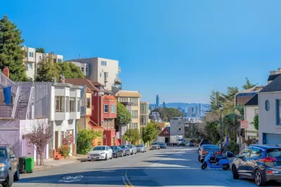
A new online tool compiles data from window-mounted computers that collect traffic data, reports Roger Rudick in Streetsblog San Francisco.
The tool brings together data from individually owned Telraam devices in the San Francisco Bay Area to allow road safety advocates to gain a better understanding of street safety and conditions.
As Rudick explains, “Residents on Lake Street in San Francisco purchased and installed the first Telraam sensors in North America and have sent several requests to SFMTA leadership begging the agency to acknowledge Telraam's data which shows daily vehicle volume and speeds exceeding thresholds set for Lake Street.” The city did not take action, saying it cannot use community-collected data to inform its decisions.
Now, the Traffic Monitoring map offers “a faster and easier way to interact with Telraam’s data so advocates can quickly pull insights from it.” Its creator, Stephen Braitsch, hopes the data will help move the needle on street safety.
FULL STORY: New ‘Traffic Monitoring’ Site Consolidates Data on Car Volumes & Speeds

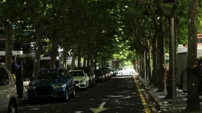
Research: More Complex Streets Are Safer
Streets that offer more perceived obstacles and distractions can force drivers to slow down and drive more carefully.

‘Complete Streets’ Webpage Deleted in Federal Purge
Basic resources and information on building bike lanes and sidewalks, formerly housed on the government’s Complete Streets website, are now gone.
NYC Congestion Pricing May Be Saving Lives
According to preliminary data, crashes and injuries dropped dramatically within the city’s new congestion relief zone.

Maui's Vacation Rental Debate Turns Ugly
Verbal attacks, misinformation campaigns and fistfights plague a high-stakes debate to convert thousands of vacation rentals into long-term housing.

Planetizen Federal Action Tracker
A weekly monitor of how Trump’s orders and actions are impacting planners and planning in America.

In Urban Planning, AI Prompting Could be the New Design Thinking
Creativity has long been key to great urban design. What if we see AI as our new creative partner?

San Francisco Mayor Backtracks on Homelessness Goal
Mayor Dan Lurie ran on a promise to build 1,500 additional shelter beds in the city, complete with supportive services. Now, his office says they are “shifting strategy” to focus on prevention and mental health treatment.

How Trump's HUD Budget Proposal Would Harm Homelessness Response
Experts say the change to the HUD budget would make it more difficult to identify people who are homeless and connect them with services, and to prevent homelessness.

The Vast Potential of the Right-of-Way
One writer argues that the space between two building faces is the most important element of the built environment.
Urban Design for Planners 1: Software Tools
This six-course series explores essential urban design concepts using open source software and equips planners with the tools they need to participate fully in the urban design process.
Planning for Universal Design
Learn the tools for implementing Universal Design in planning regulations.
Gallatin County Department of Planning & Community Development
Heyer Gruel & Associates PA
JM Goldson LLC
Mpact (founded as Rail~Volution)
City of Camden Redevelopment Agency
City of Astoria
Jefferson Parish Government
Camden Redevelopment Agency
City of Claremont