


New York City created a Google Maps layer to help residents and tourists alike more easily locate public restrooms.
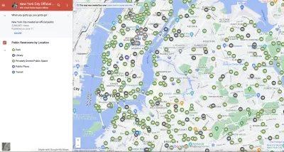
Accessibility of public restrooms is an often overlooked yet critical aspect of the urban experience. Because if there is one universal truth, it is, “When you gotta go you gotta go.” According to a recent Bloomberg CityLab article, New York City recently acknowledged that truth when it built and released a Google Map layer that shows the city’s nearly 1,000 public toilets.
The new map, which Bloomberg reporter Sarah Holder reports was viewed 2.5 million times in the first few weeks of its launch, shows the location and operating hours of free restroom facilities in parks, plazas, libraries, and transit centers across the city. It is part of a broader city initiative called “Ur In Luck” to increase accessibility to public toilets, which also aims to create 46 new and renovate 36 existing park restrooms over the next five years. The plan includes an additional 14 self-cleaning public toilets as well.
Access to restrooms is one of humans’ most basic needs, which begs the question: Can a city be truly livable without it? With its current initiative, New York City seems to have acknowledged their importance. Will NYC serve as a role model for the many other U.S. cities that lack adequate restroom facilities?
FULL STORY: The Quest for a Public Bathroom in New York City


Meet NYC’s New Office of Livable Streets
The NYC DOT program will build on pandemic-era initiatives to promote safe and comfortable streets that enhance community and expand uses beyond just moving cars.

New York City Parks Getting Modular Public Bathrooms
The ‘Portland Loo,’ named after its birth city, is designed to withstand year-round weather and resist vandalism.
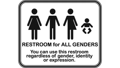
Sometimes Gender Neutral Bathrooms Have Nothing to Do With Gender Identity
There are several reasons that gender neutral bathrooms will soon replace separated men's and women's bathrooms, and they have nothing to do with gender identity, explains Jimmy Parker, event producer and former BID director.

Planetizen Federal Action Tracker
A weekly monitor of how Trump’s orders and actions are impacting planners and planning in America.

Map: Where Senate Republicans Want to Sell Your Public Lands
For public land advocates, the Senate Republicans’ proposal to sell millions of acres of public land in the West is “the biggest fight of their careers.”

Restaurant Patios Were a Pandemic Win — Why Were They so Hard to Keep?
Social distancing requirements and changes in travel patterns prompted cities to pilot new uses for street and sidewalk space. Then it got complicated.

Maui's Vacation Rental Debate Turns Ugly
Verbal attacks, misinformation campaigns and fistfights plague a high-stakes debate to convert thousands of vacation rentals into long-term housing.

San Francisco Suspends Traffic Calming Amidst Record Deaths
Citing “a challenging fiscal landscape,” the city will cease the program on the heels of 42 traffic deaths, including 24 pedestrians.

California Homeless Arrests, Citations Spike After Ruling
An investigation reveals that anti-homeless actions increased up to 500% after Grants Pass v. Johnson — even in cities claiming no policy change.
Urban Design for Planners 1: Software Tools
This six-course series explores essential urban design concepts using open source software and equips planners with the tools they need to participate fully in the urban design process.
Planning for Universal Design
Learn the tools for implementing Universal Design in planning regulations.
Heyer Gruel & Associates PA
JM Goldson LLC
Custer County Colorado
City of Camden Redevelopment Agency
City of Astoria
Transportation Research & Education Center (TREC) at Portland State University
Camden Redevelopment Agency
City of Claremont
Municipality of Princeton (NJ)