


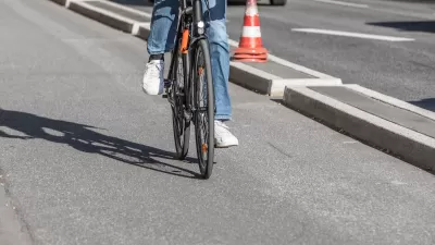
Strava just announced the ten-year anniversary of Metro, a proprietary web platform that provides data insights to partner organizations to make active transportation better for cyclists and pedestrians.

The mobile app Strava, which incorporates social networking features, is a popular tool for tracking physical activity. Starting out tracking mostly outdoor cycling and running activities using Global Positioning System data, Strava now incorporates various other exercise types including indoor activities. Strava just announced the ten-year anniversary of Metro, the web platform that provides data insights to make active transportation better for cyclists and pedestrians. With Metro, Strava's goal is to power smarter and more sustainable infrastructure globally and to give back to the communities that support millions of users around the world.
Created in 2013, Metro provides de-identified, aggregated bicycle and pedestrian trip insights to planners, advocacy groups, researchers, and other interested parties. Active community members who have opted-in and track their trips on Strava are anonymously feeding into the Metro dataset and in turn, helping planners and transportation experts in their communities to understand mobility patterns, identify opportunities for investment, and evaluate the impact of infrastructure changes, giving more opportunity through improved transportation access.
Examples of organizations that have successfully applied Strava Metro data include the Atlanta Department of Transportation, Los Angeles County Department of Parks and Recreation, the city of Paris, and the government of Catalonia. Globally, users have uploaded more than eight billion activities to Strava and nearly five billion miles traveled by walking or cycling. When the community contributes their activities to Metro, they become a critical part of one of the world’s largest collections of mobility data.
FULL STORY: Strava’s Metro Reaches Significant Milestone of 10 Year Anniversary

Southeast LA Road Safety Advocates Call for Improved Infrastructure
Streets in southeastern Los Angeles County have a severe lack of protected bike lanes and traffic safety measures, leading to high numbers of fatalities in a community where many residents depend on walking and biking for daily needs.

Minnesota Awards Active Transportation Grants
The grants are aimed at helping cities create action plans for improving their bike and pedestrian networks.

The Business Case for Multimodal Transportation Planning
Travel demands are changing and so should planning. There are good reasons for communities to spend less on automobile facilities and more on walking, bicycling, and public transit. Let’s examine why.

Planetizen Federal Action Tracker
A weekly monitor of how Trump’s orders and actions are impacting planners and planning in America.

Maui's Vacation Rental Debate Turns Ugly
Verbal attacks, misinformation campaigns and fistfights plague a high-stakes debate to convert thousands of vacation rentals into long-term housing.

San Francisco Suspends Traffic Calming Amidst Record Deaths
Citing “a challenging fiscal landscape,” the city will cease the program on the heels of 42 traffic deaths, including 24 pedestrians.

Amtrak Rolls Out New Orleans to Alabama “Mardi Gras” Train
The new service will operate morning and evening departures between Mobile and New Orleans.

The Subversive Car-Free Guide to Trump's Great American Road Trip
Car-free ways to access Chicagoland’s best tourist attractions.

San Antonio and Austin are Fusing Into one Massive Megaregion
The region spanning the two central Texas cities is growing fast, posing challenges for local infrastructure and water supplies.
Urban Design for Planners 1: Software Tools
This six-course series explores essential urban design concepts using open source software and equips planners with the tools they need to participate fully in the urban design process.
Planning for Universal Design
Learn the tools for implementing Universal Design in planning regulations.
Heyer Gruel & Associates PA
JM Goldson LLC
Custer County Colorado
City of Camden Redevelopment Agency
City of Astoria
Transportation Research & Education Center (TREC) at Portland State University
Jefferson Parish Government
Camden Redevelopment Agency
City of Claremont