


Largely used for free car parking, urban curb space is becoming a more precious commodity.
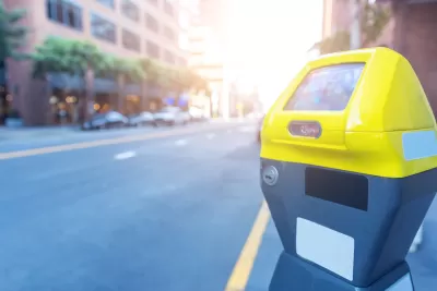
An article by Nathaniel Meyersohn on CNN highlights the need for cities to more carefully manage their curb space, a move parking reform advocates have been suggesting for years.
As planners know, “Parking is a third-rail issue in politics. Drivers and business owners usually rebel at any proposed changes.” But in the wake of the pandemic, which demonstrated how curb space can be quickly and cheaply repurposed into more usable public or dining space, cities are finally rethinking the curb and how demand-based pricing can manage supply and bring in revenue.
Meyersohn adds, “San Francisco, Baltimore, Boston, Los Angeles, Milwaukee, Pittsburgh, Seattle and Washington, DC, are among the cities to charge market prices in recent years for on-street parking. New York City’s Department of Transportation is creating a demand-based pricing ‘proof of concept’ this year.”
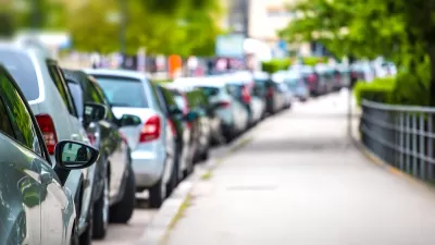
Curb space is also becoming more desirable for uses other than car parking, including outdoor dining, deliveries, and bike lanes. Some cities are using ‘smart loading zones’ to let delivery drivers reserve loading spots and adjust prices based on demand, while others are introducing cargo bikes as an alternative to delivery vehicles.
FULL STORY: Why cities are cracking down on free parking

Video: How Much Should Parking Cost?
Variable parking pricing can offer some of the same benefits as congestion pricing.
Reimagining the Curb: How Smart Curb Management is Transforming Urban Mobility
Modern demands for curbside space call for new ways to manage and allocate it.
NYC Launches ‘Smart Curbs’ Program
The pilot program on the Upper West Side will remove some curbside parking spots to replace them with public seating, bike racks, and delivery zones.

Maui's Vacation Rental Debate Turns Ugly
Verbal attacks, misinformation campaigns and fistfights plague a high-stakes debate to convert thousands of vacation rentals into long-term housing.

Planetizen Federal Action Tracker
A weekly monitor of how Trump’s orders and actions are impacting planners and planning in America.

In Urban Planning, AI Prompting Could be the New Design Thinking
Creativity has long been key to great urban design. What if we see AI as our new creative partner?

King County Supportive Housing Program Offers Hope for Unhoused Residents
The county is taking a ‘Housing First’ approach that prioritizes getting people into housing, then offering wraparound supportive services.

Researchers Use AI to Get Clearer Picture of US Housing
Analysts are using artificial intelligence to supercharge their research by allowing them to comb through data faster. Though these AI tools can be error prone, they save time and housing researchers are optimistic about the future.

Making Shared Micromobility More Inclusive
Cities and shared mobility system operators can do more to include people with disabilities in planning and operations, per a new report.
Urban Design for Planners 1: Software Tools
This six-course series explores essential urban design concepts using open source software and equips planners with the tools they need to participate fully in the urban design process.
Planning for Universal Design
Learn the tools for implementing Universal Design in planning regulations.
planning NEXT
Appalachian Highlands Housing Partners
Mpact (founded as Rail~Volution)
City of Camden Redevelopment Agency
City of Astoria
City of Portland
City of Laramie