


The new program targets neighborhood streets for safety improvements such as speed humps and intersection redesigns.

Boston Mayor Michelle Wu announced a plan to install hundreds of new speed humps and intersection safety improvements, reports Christian MilNeil in Streetsblog Mass, replacing the Neighborhood Slow Streets program created during the Walsh administration which, Milneil explains, “was extremely popular, but … was also resource-intensive, and its projects typically took multiple years to emerge from concept to construction.”
The new approach, dubbed a ‘safety surge’ by the city, focuses on comprehensive and quick traffic calming improvements. “By redesigning intersections and roadways, and improving traffic signals, we will help people get around while making sure our community members are safe,” said Mayor Wu in a press release. “The city says it aims to install up to 500 new speed humps on an annual basis on smaller neighborhood side streets.”
According to MilNeil, “Another element of the ‘safety surge’ will aim to slow down motor vehicles at crash-prone intersections, with a particular focus on intersections near parks, schools, community centers, or housing for older adults.”
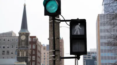
The initiative also updates the city’s traffic signal policy to consider pedestrian safety. “The new edition requires the city’s engineers to consider new performance measures for evaluating traffic signal operations, including pedestrian delay and ‘Lowest Pedestrian Speed Accommodated.’”
FULL STORY: Wu Admin Announces ‘Safety Surge’ of Traffic Calming for Neighborhood Streets

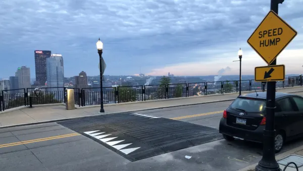
Pittsburgh Excels at Low-Cost, Quick-Build Traffic Calming
The city’s traffic calming initiative has led to a 6 percent average reduction in speeds on corridors with recent interventions.
Milwaukee Announces 60 Traffic Calming Projects for 2025
The city has successfully reduced traffic deaths and aims to eliminate them completely within the next decade.
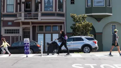
San Francisco Slow Streets Bucks Citywide Trend, Reducing Injuries by 61 Percent
Low-cost interventions aimed at slowing traffic are making a major impact on road safety.

Maui's Vacation Rental Debate Turns Ugly
Verbal attacks, misinformation campaigns and fistfights plague a high-stakes debate to convert thousands of vacation rentals into long-term housing.

Planetizen Federal Action Tracker
A weekly monitor of how Trump’s orders and actions are impacting planners and planning in America.

In Urban Planning, AI Prompting Could be the New Design Thinking
Creativity has long been key to great urban design. What if we see AI as our new creative partner?

King County Supportive Housing Program Offers Hope for Unhoused Residents
The county is taking a ‘Housing First’ approach that prioritizes getting people into housing, then offering wraparound supportive services.

Researchers Use AI to Get Clearer Picture of US Housing
Analysts are using artificial intelligence to supercharge their research by allowing them to comb through data faster. Though these AI tools can be error prone, they save time and housing researchers are optimistic about the future.

Making Shared Micromobility More Inclusive
Cities and shared mobility system operators can do more to include people with disabilities in planning and operations, per a new report.
Urban Design for Planners 1: Software Tools
This six-course series explores essential urban design concepts using open source software and equips planners with the tools they need to participate fully in the urban design process.
Planning for Universal Design
Learn the tools for implementing Universal Design in planning regulations.
planning NEXT
Appalachian Highlands Housing Partners
Mpact (founded as Rail~Volution)
City of Camden Redevelopment Agency
City of Astoria
City of Portland
City of Laramie