


One of the premier planning events of the year is underway in D.C.
Andy Boenau is blogging from the Transportation Research Board Annual Meeting (TRBAM), which got underway over the weekend and will run until Thursday of this week, including a discussion of problems versus solutions as a useful conceptual framework for planners.
Boenau writes, for an example of the difference between problems and solutions: “Henry Ford’s customers were in love with a solution—a faster horse. Henry Ford was in love with a problem—clunky manufacturing processes.”
Thus, Boenau is attendeding the TRBAM on the search for problems:
Eye-detection software, warning lights that communicate with each other, cheap pavement materials, and real-time data illustrating origins and destinations… there are a ton of solutions being pitched by researchers and practitioners this week. The better they are at describing the problem they’re in love with, the more likely the traveling public will benefit.
Boenau and others are actively live tweeting the proceedings at #TRBAM, so check out that hashtag at if you weren’t able to attend the conference in Washington, D.C. this week. The article linked below is on Substack, but is accessible to the public.
FULL STORY: Fixing mobility problems or forcing mobility solutions

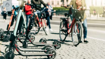
Small Modes Are Beautiful!
Active modes (walking, bicycling and their variants) and micromodes (e-bikes and e-scooters) can provide large climate emission reductions and other important benefits, if we let them. Small modes are important but often undercounted and undervalued.
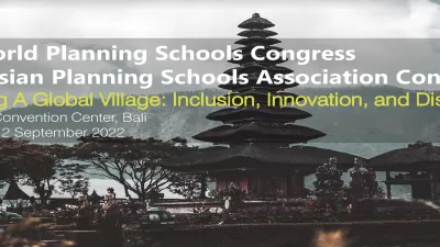
World Planning Educators To Meet in Indonesia
The fifth World Planning Schools Congress this coming August, organized on the theme Planning a Global Village: Inclusion, Innovation, and Disruption, will step up cross-border movement of planning ideas and practices.

Annual Google Scholar Citation Data for Planning Faculty
Publish or perish?

Planetizen Federal Action Tracker
A weekly monitor of how Trump’s orders and actions are impacting planners and planning in America.

Map: Where Senate Republicans Want to Sell Your Public Lands
For public land advocates, the Senate Republicans’ proposal to sell millions of acres of public land in the West is “the biggest fight of their careers.”

Restaurant Patios Were a Pandemic Win — Why Were They so Hard to Keep?
Social distancing requirements and changes in travel patterns prompted cities to pilot new uses for street and sidewalk space. Then it got complicated.

Platform Pilsner: Vancouver Transit Agency Releases... a Beer?
TransLink will receive a portion of every sale of the four-pack.

Toronto Weighs Cheaper Transit, Parking Hikes for Major Events
Special event rates would take effect during large festivals, sports games and concerts to ‘discourage driving, manage congestion and free up space for transit.”

Berlin to Consider Car-Free Zone Larger Than Manhattan
The area bound by the 22-mile Ringbahn would still allow 12 uses of a private automobile per year per person, and several other exemptions.
Urban Design for Planners 1: Software Tools
This six-course series explores essential urban design concepts using open source software and equips planners with the tools they need to participate fully in the urban design process.
Planning for Universal Design
Learn the tools for implementing Universal Design in planning regulations.
Heyer Gruel & Associates PA
JM Goldson LLC
Custer County Colorado
City of Camden Redevelopment Agency
City of Astoria
Transportation Research & Education Center (TREC) at Portland State University
Camden Redevelopment Agency
City of Claremont
Municipality of Princeton (NJ)